Colorado Trail 2024 – Path of Solitude – Day 4 Border of Lost Creek Wilderness to Long Gulch
Distance hiked: 25,1 km/15,6 mi Elevation gain: 785 m/2575 ft Highest point: 3331 m/10928 ft (data from my GPS watch, may be different from the official measurements)
Disclaimer: Human written post with some minor AI improvements (to improve non-native speaker flaws). Photos edited in Affinity Photo 2
Today, there was a subtle but noticeable shift – both in the landscape around me and in how I experienced it. This had a lot to do with the gain in altitude, now reaching well above 3,000 m / 10,000 ft. That’s more than 1,500 m / 5,000 ft higher than the starting point in Waterton Canyon.
My alarm woke me at 5:45 am, but I decided to stay a little longer in my sleeping bag. Eventually, that meant I didn’t hit the trail until 8:20 am. Still, I had a peaceful night and felt well-rested.
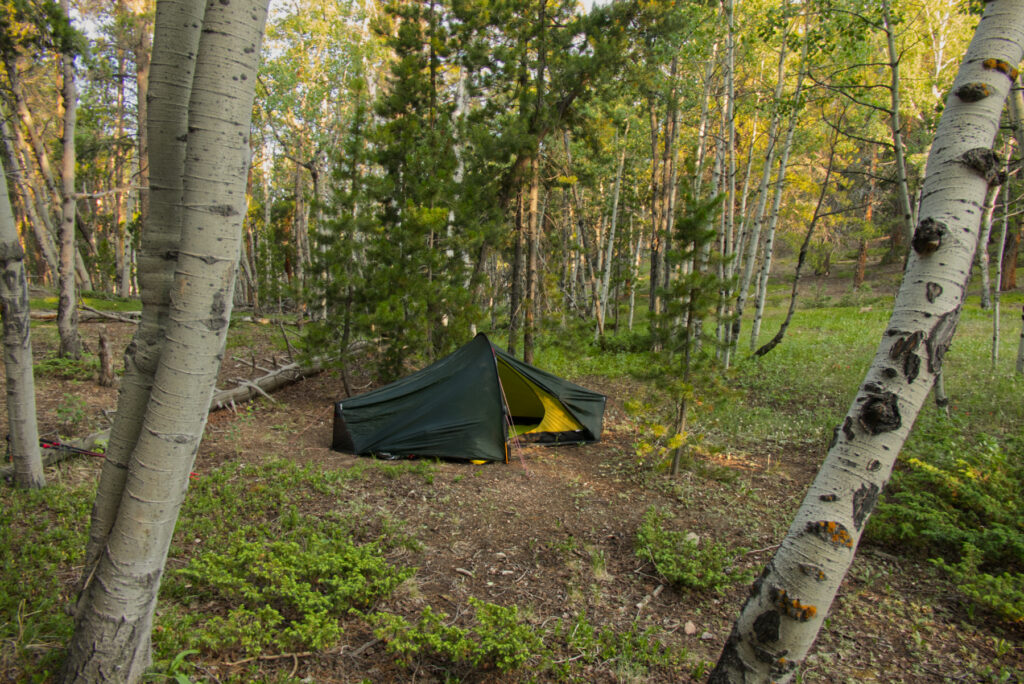
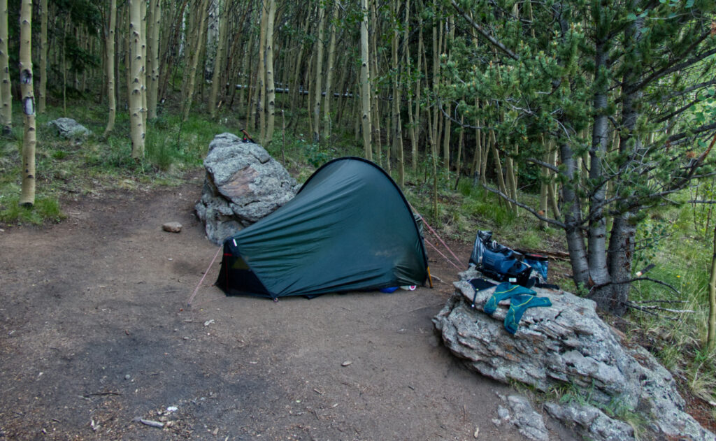
A beautiful spot for my tent next to the Lost Creek Wilderness Area
It was different, waking up completely alone in this beautiful forest clearing. I think it was the first time I truly felt that quiet sense of freedom: choosing my path, setting my pace, planning the day on my own terms. No human interaction, no distractions. Just me.
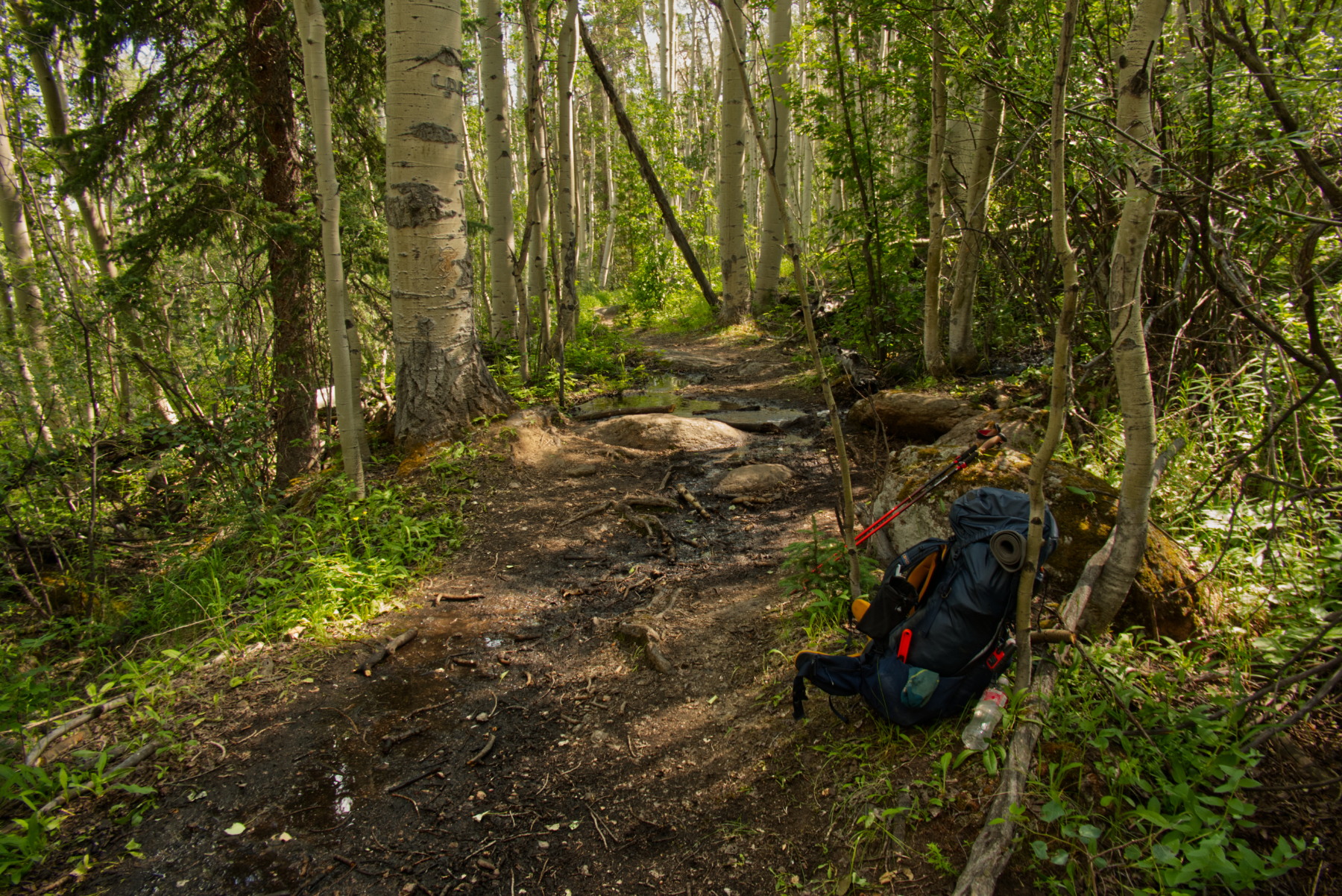
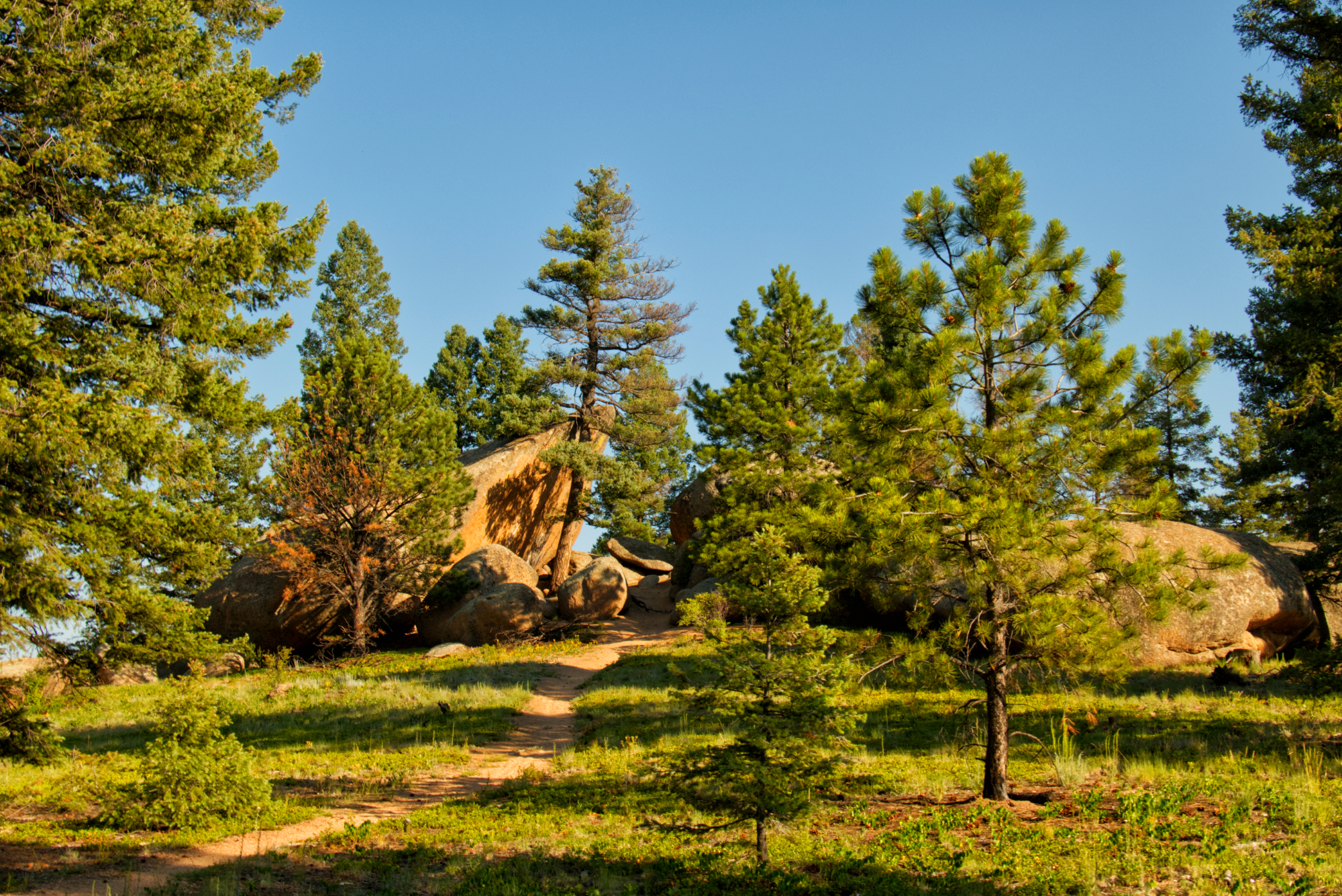
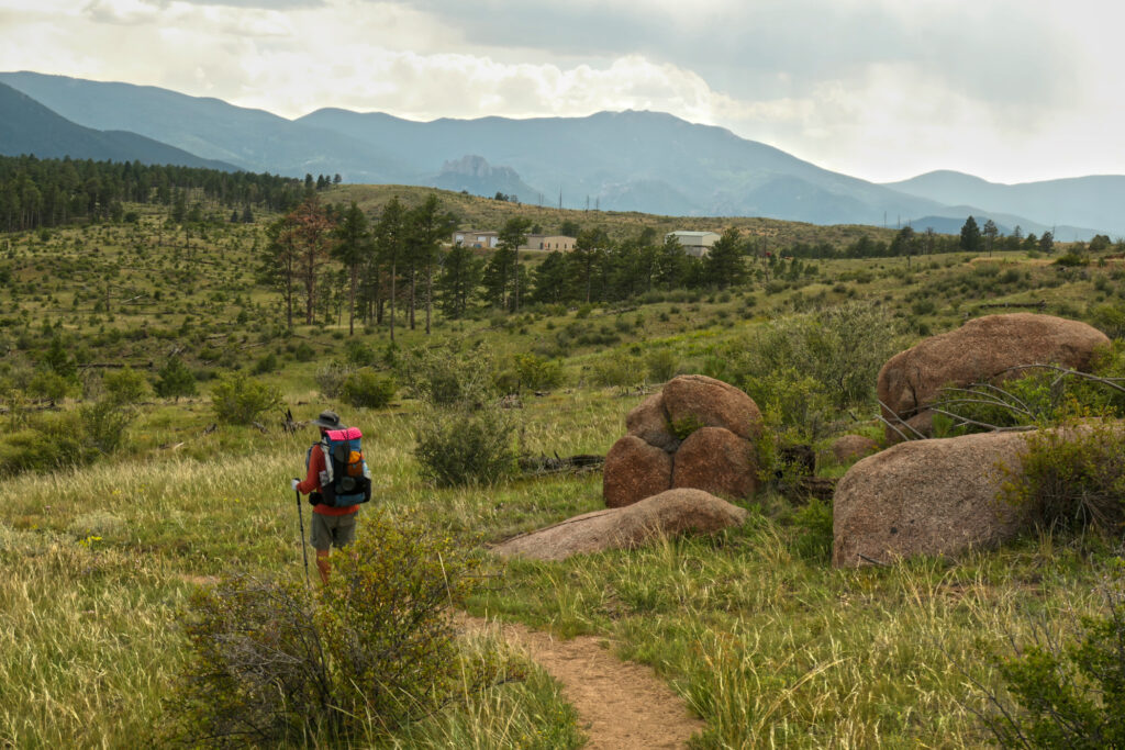
Not long after setting off, I entered the Lost Creek Wilderness. The trail was sometimes steep and rocky, then eased into lovely aspen groves with little creeks and lots of wildflowers, following an old logging road. After a few miles, the path left the road and turned into a proper leg burner – steep, rooty, rocky. I was huffing and puffing, but eventually reached the first high point of the day.
A nice place to get some fresh water
Around there, a small creek invited me to filter some fresh water. A few other hikers showed up, and we shared a short, friendly exchange. And remember how I wrote on Day 2 that I had lost my National Geographic map? Well – one of the guys came over and asked if someone had dropped a map in the burn area… Yep. That was mine. That’s the hiker community for you – helpful, observant, kind.
That was just one of many little trail moments that make this journey so special. So thanks again, my friend. I’m sorry I didn’t ask your name. We only saw each other once more in Twin Lakes. I hope the trail – and everything beyond – treated you well.
And yes, I still preferred to hike and camp alone for the most part. But it was nice to feel part of this bigger hiking community, where everyone hikes their own hike, at their own pace, with mutual respect along the way.
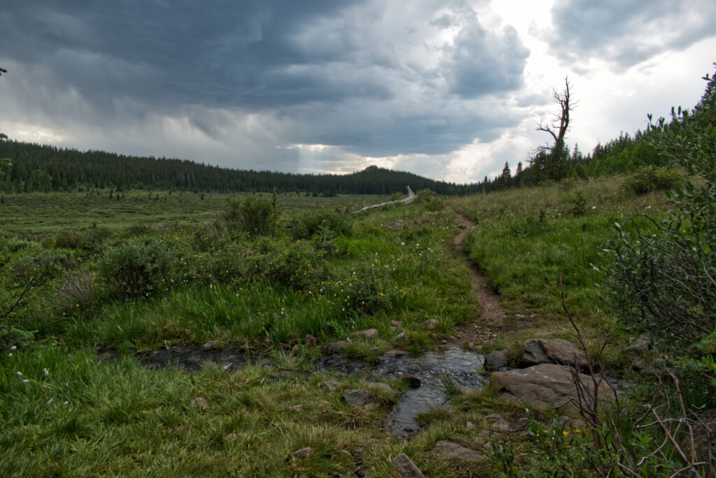
Later, going downhill for a bit, the first thunderstorm of my hike rolled in. I felt safe in the woods, and after less than half an hour, the rain and thunder had moved on.
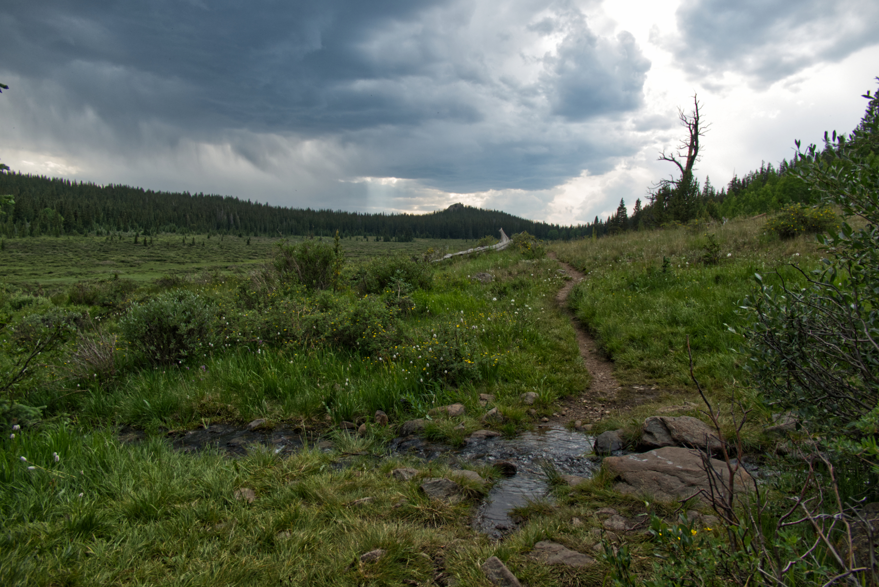
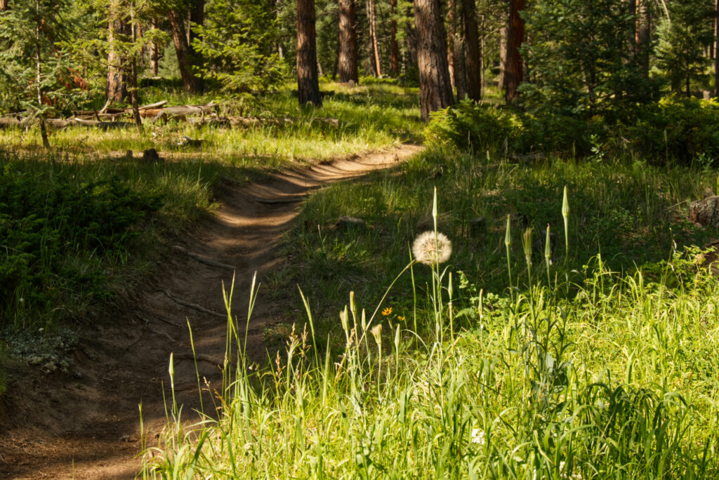
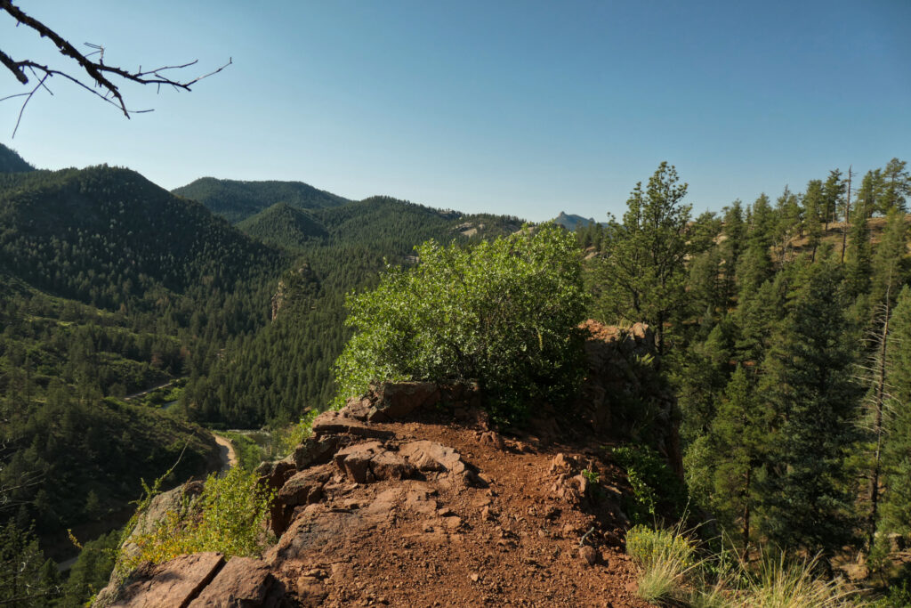
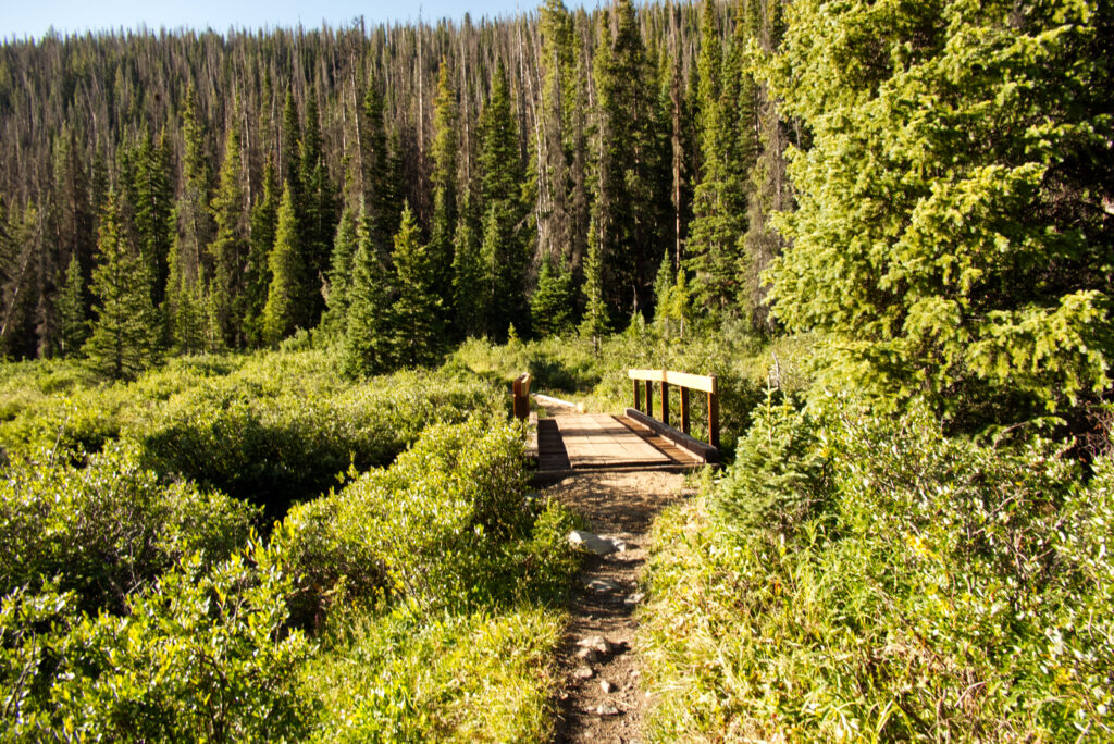
Entering the Long Gulch after descending through the forest
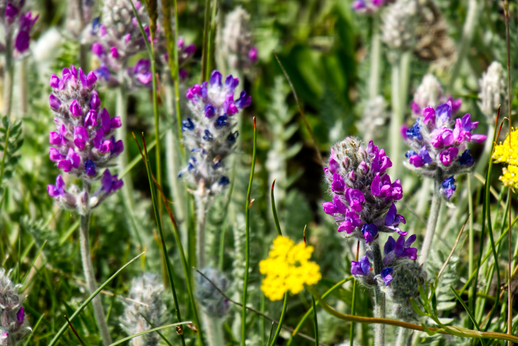
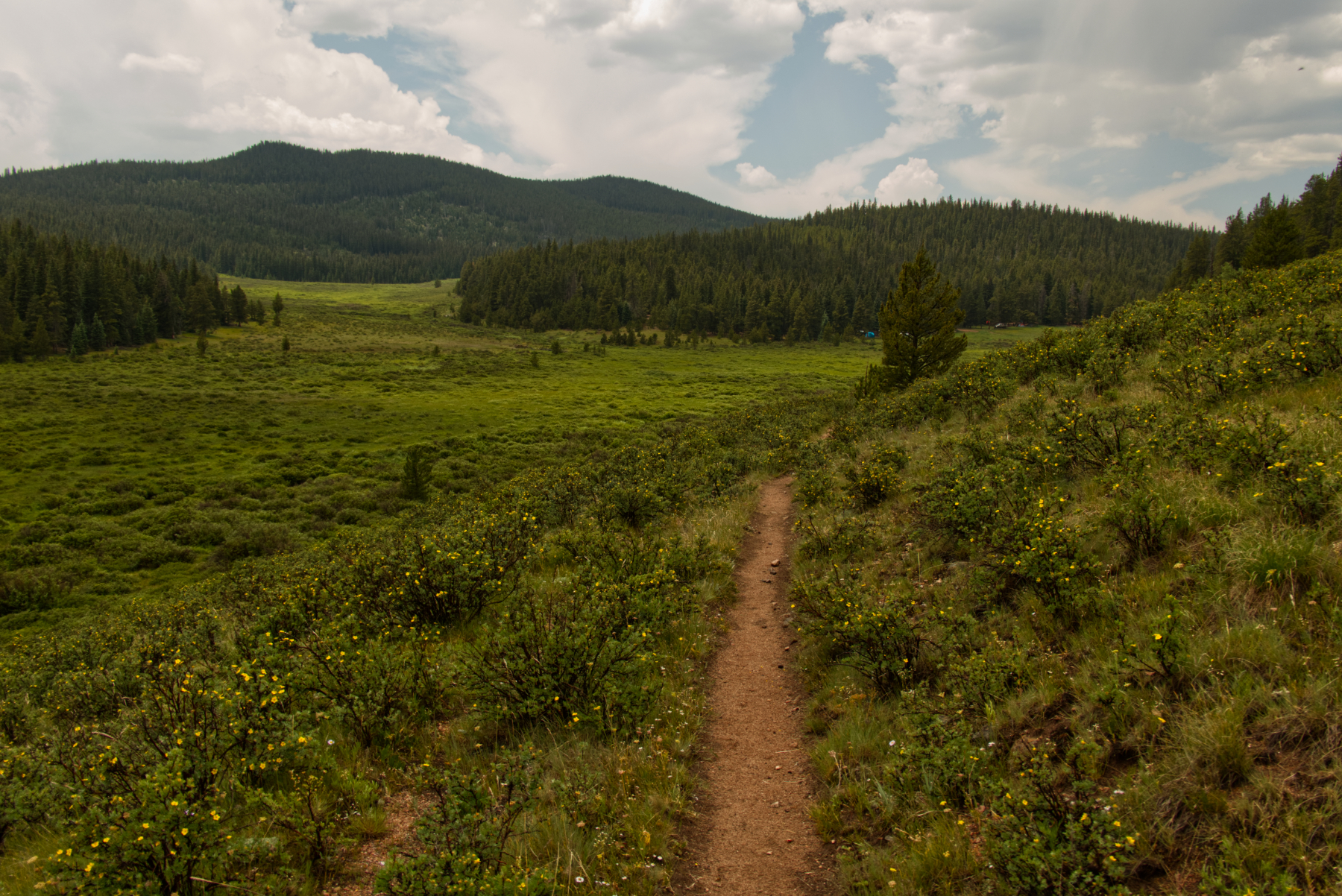
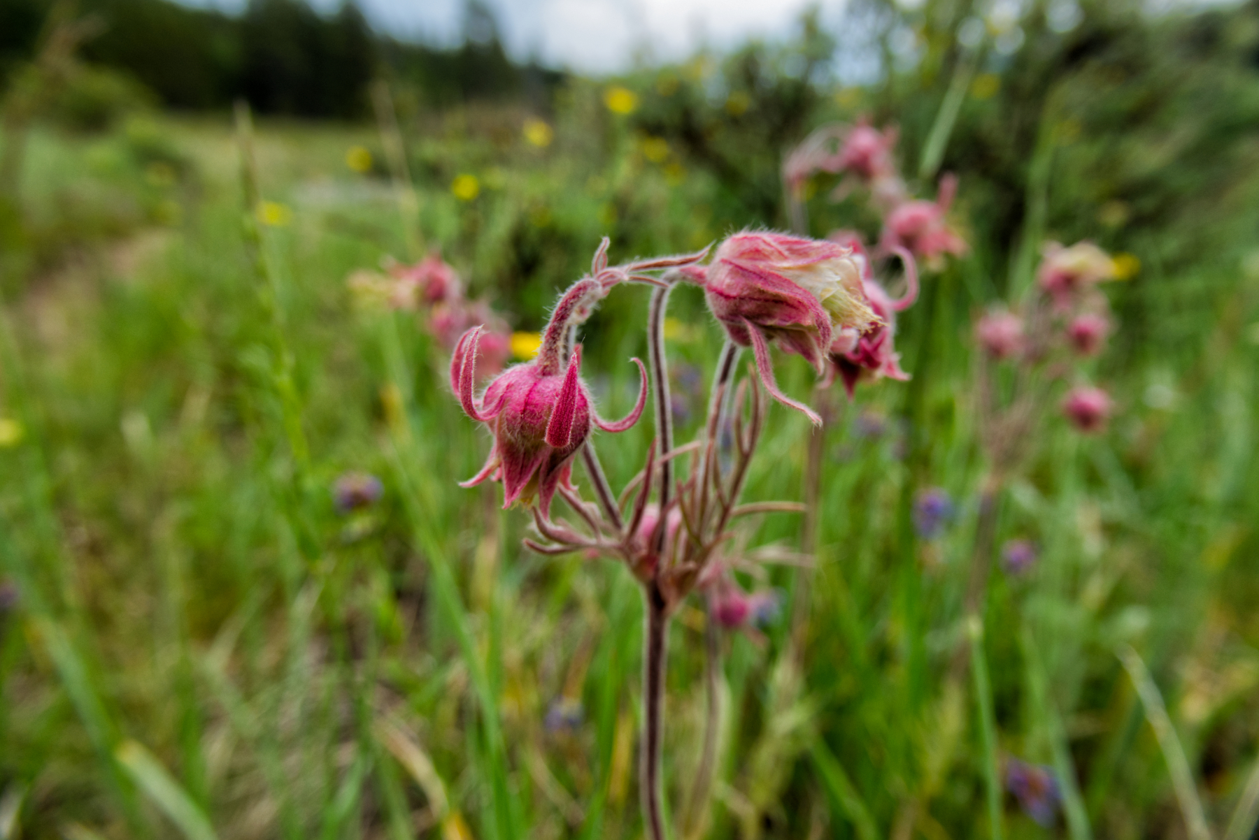
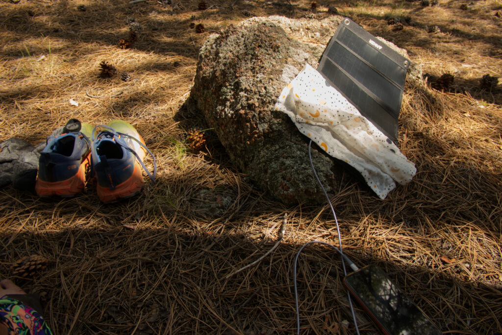
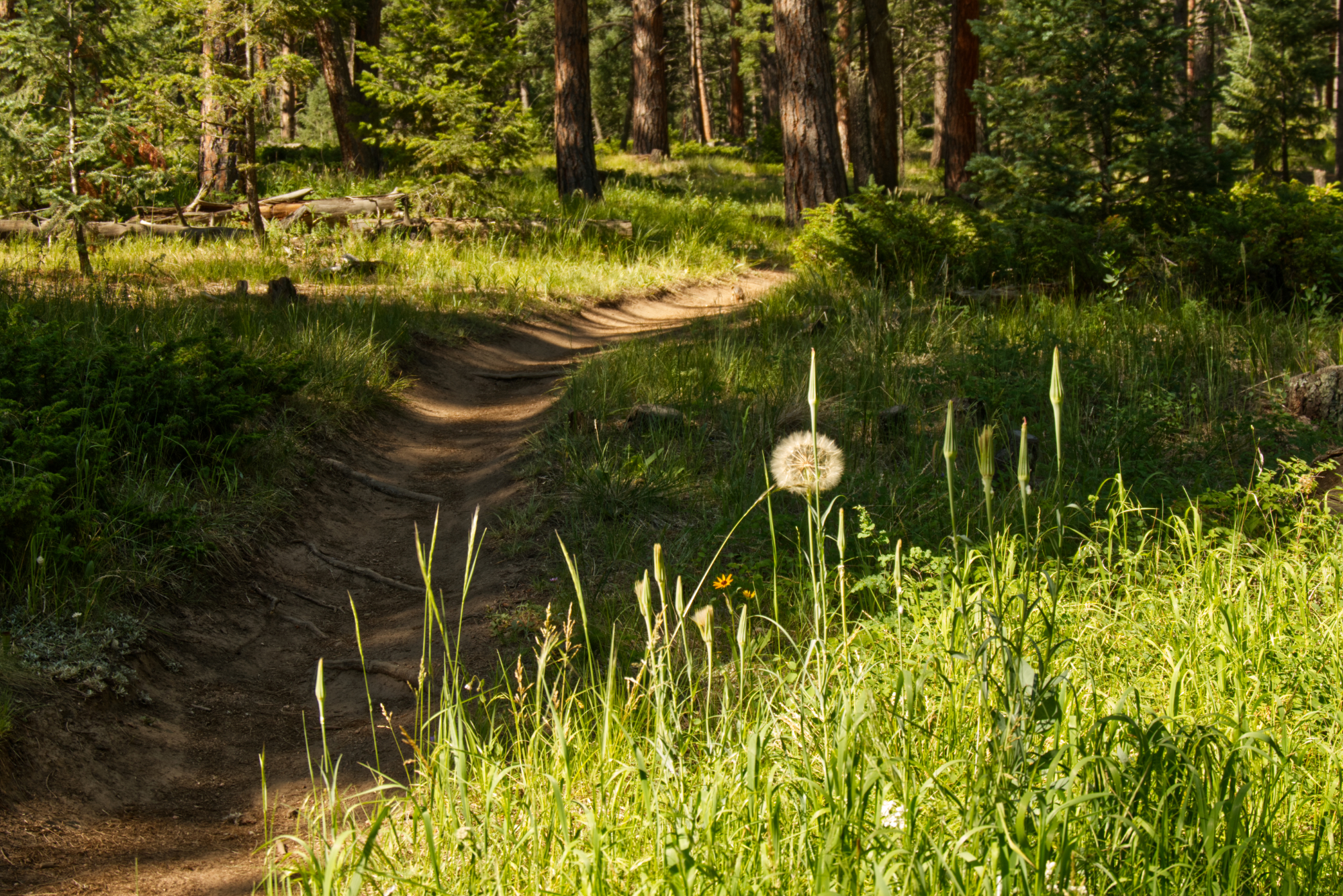
Then came a stunning stretch, following the North Fork of Lost Creek, also known as Long Gulch. What a place. A gentle, steady ascent. Around every creek, an explosion of wildflowers. Blue skies, white clouds straight out of a postcard. For seven miles, it felt like walking through a painting. And yes, I was sweating again – but the heat had lost its sting compared to earlier days. I paused under a pine tree, aired out my feet, recharged my gear with the solar panel. This part of the trail felt extra good.
Near the upper end (or beginning?) of Long Gulch
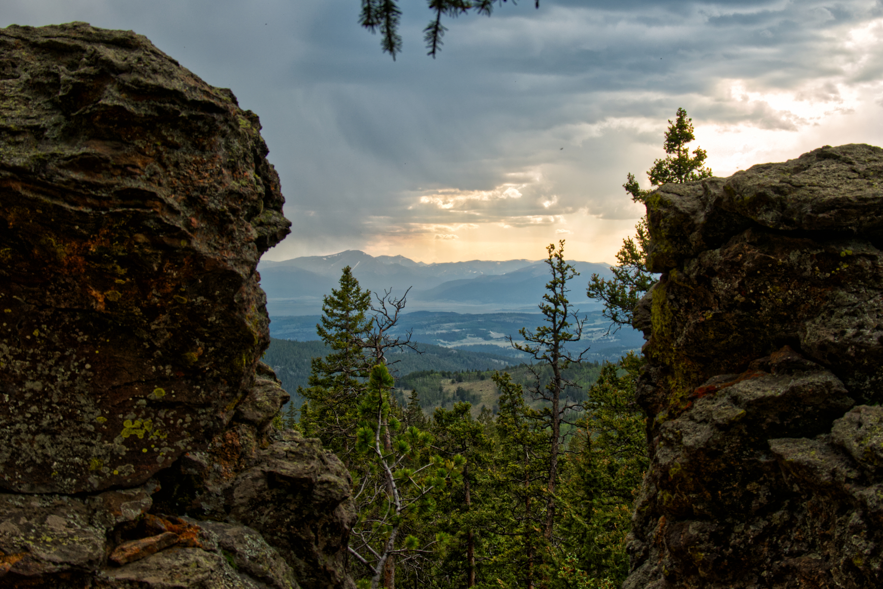
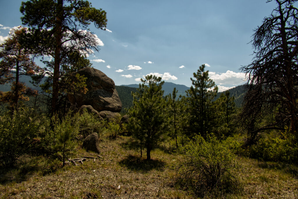
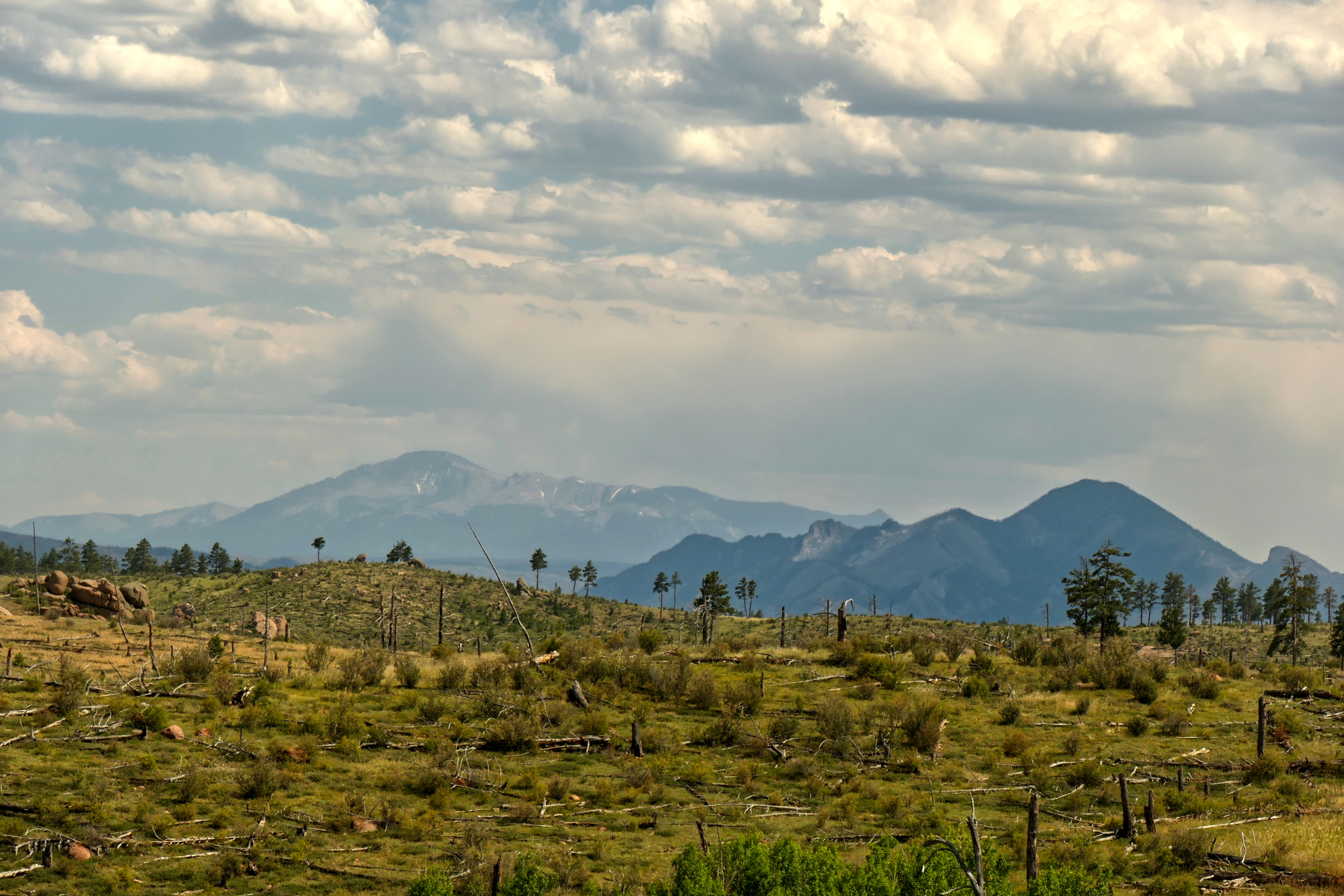
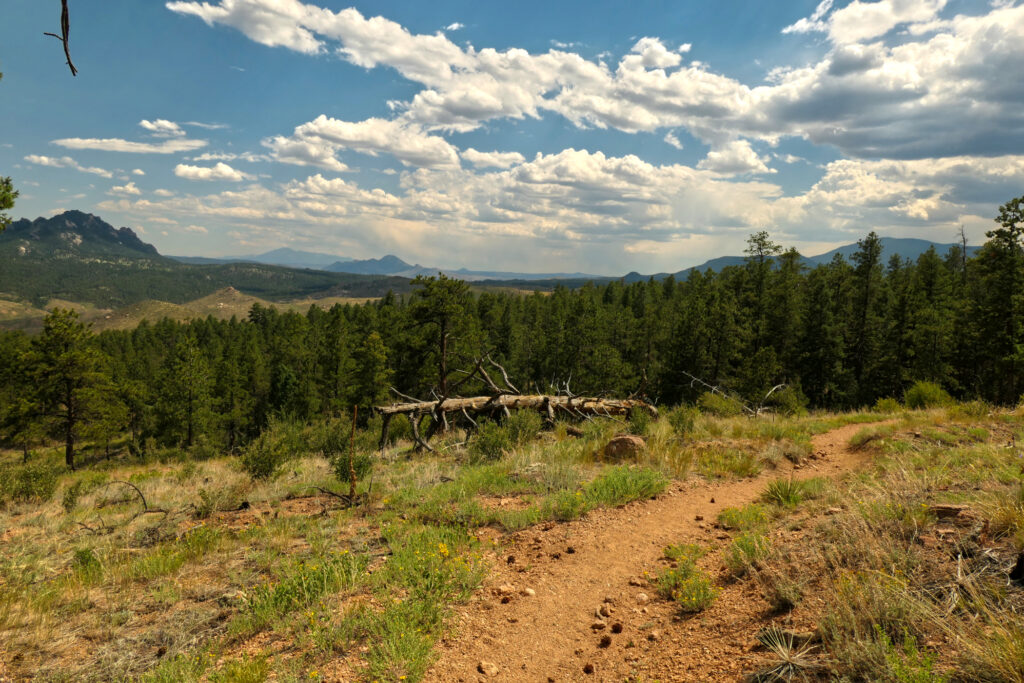
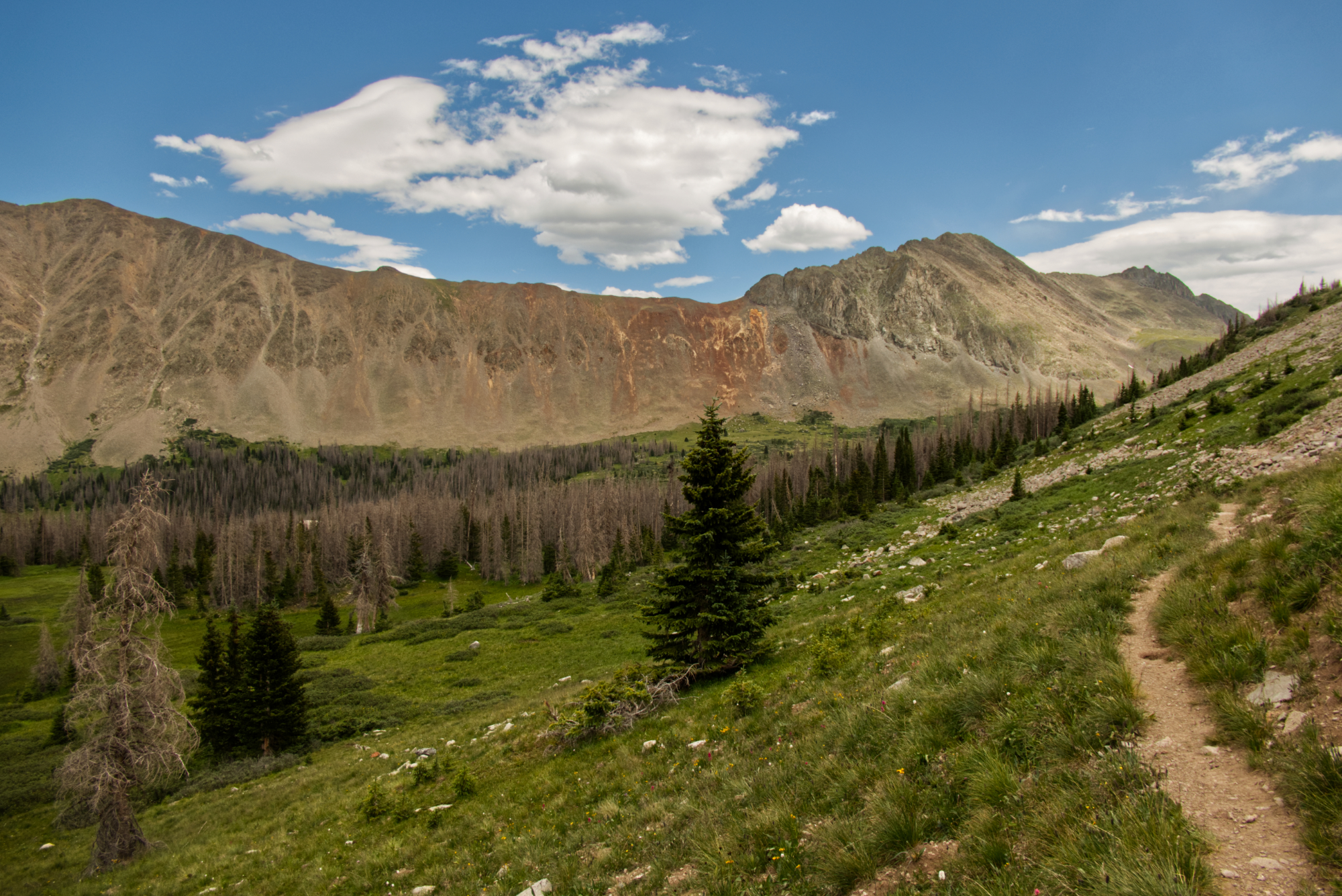
Eventually, the gulch ended and I re-entered the forest. There were some perfect tent spots, and I met two friendly guys who had already set up camp. But I still felt strong, so I kept going – descending quite a bit until I reached the creek above Long Gulch Trailhead. The skies were already turning gloomy again. A short but spectacular view opened between some rocks – mountain ranges in the distance, a glimpse into the next days of my hike!
A view of mountain ranges across South Park
When I arrived, I was a bit shocked – there were about a dozen tents already scattered around. One small spot was still free, but one of the hikers told me there was another site just across the creek.
I crossed over and found the perfect place for the night. Alone again, just how I needed it to be. I noticed that the bark of some aspen trees had been rubbed off. My first thought (naturally) was: bears. Claws. Yikes. But I later learned these are likely marks from elk or moose scratching their antlers.
I decided not to overthink it. I stashed my bear canister far from the tent, had a peaceful evening listening to light rain, wrote a bit, and fell asleep deeply.
Tips, experiences, lessons learned
One thing I never quite nailed on this hike: water management. I always wanted to be safe and carry enough. But on a segment like today, with plenty of water sources, I probably hauled an extra 1–2 lbs of unneeded weight. It’s not easy to find the perfect balance, but next time, I might trust the map (and my instincts) a bit more.
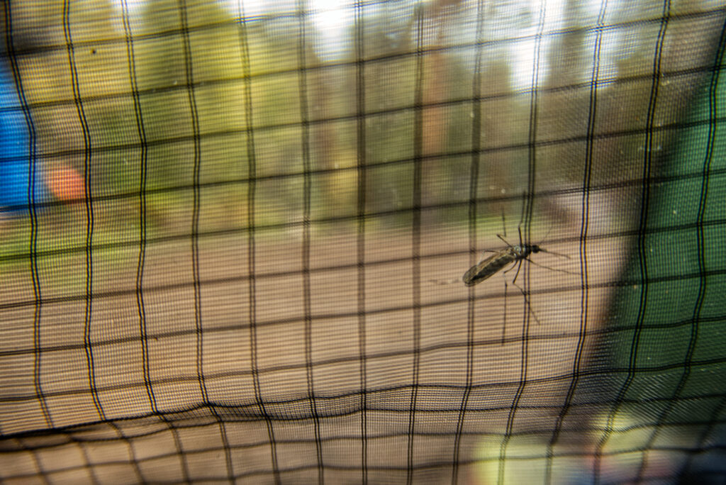
Another little lesson: In Long Gulch, there were some mosquitoes. Not terrible – just mildly annoying when taking breaks. While resting under a large pine tree, I noticed that the mosquitos mostly stayed away from the ground covered in pine needles. So at least in this area, pine shade = nap zone. Good to know.
Colorado Trail 2024 – Path of Solitude – Day 3 Little Scraggy Trailhead to border of Lost Creek Wilderness
Distance hiked: 25,7 km/16 mi Elevation gain: no measurement today Highest point: 2680 m/8793 ft (data from my GPS watch, may be different from the official measurements)
Waking up in this open forest, maybe half a mile before Little Scraggy Trailhead, I felt well-rested after a good night’s sleep. What surprised me most was the silence. I had expected some night birds or little animals rustling in the undergrowth. But most of the time? Absolute stillness. Strange, yes – but I absolutely enjoyed it.
I got up at six and left at 7:45 – already a small improvement compared to yesterday. Greg had taken off a bit earlier, and we leapfrogged a few times throughout the day.
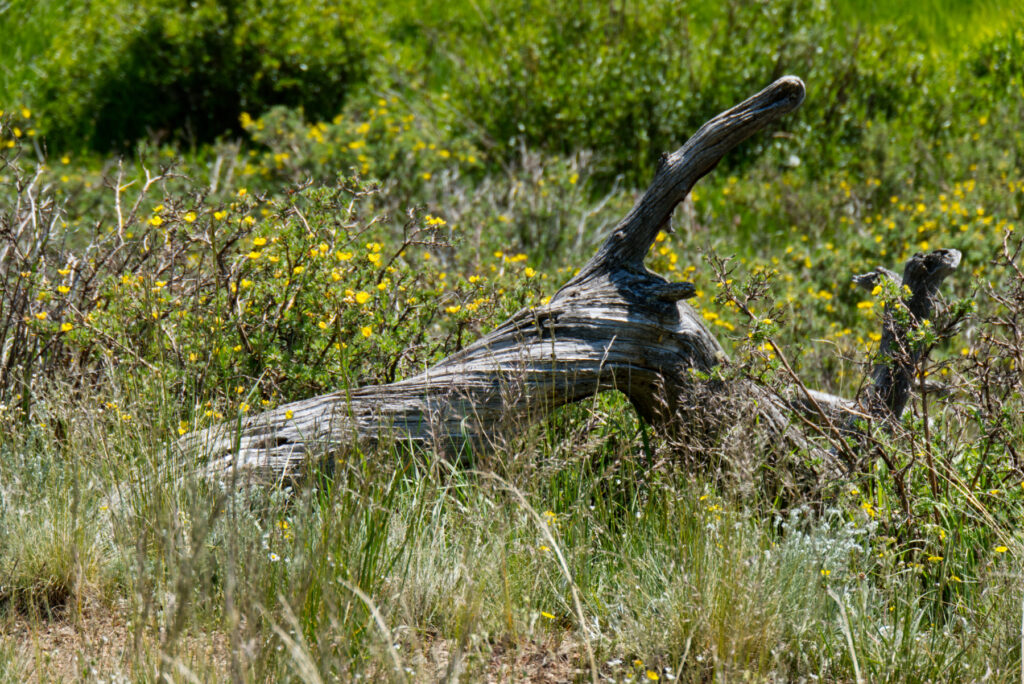
Granite outcrop
The summer heat was already building as I approached the trailhead, but the trail stayed mostly in the woods today – a welcome relief.
I enjoyed the presence of more water on this section. I filled up my bottles at several little creeks along the way. While most of the trail passed through pine forests, each water source seemed to come with its own micro-oasis: aspen trees, blooming wildflowers, lush green grass. A refreshing contrast to the dry, exposed stretch the day before.
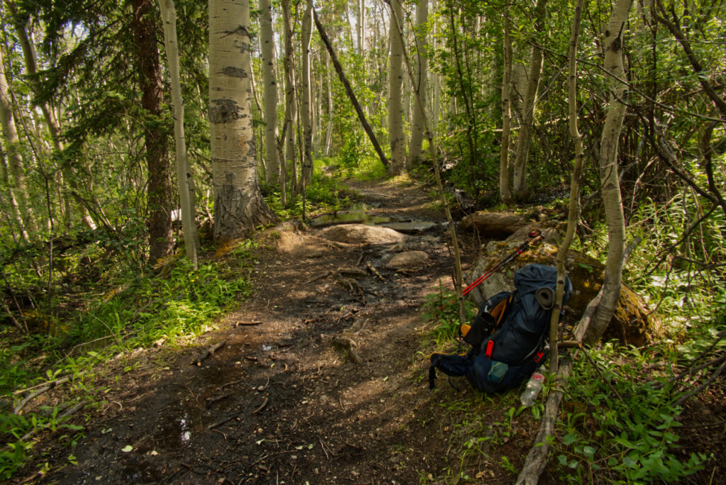
Enjoying the trail
At one point, I paused to watch a woodpecker hammering away on a small aspen tree. Each time it flew off, a hummingbird zipped in to lick the fresh sap. Then the woodpecker returned, undeterred, and kept drilling. This went on for a while – and honestly, it was hilarious. Like a perfectly choreographed forest routine.
The trail itself was smooth and easy to follow. Being a Friday, there were only a handful of mountain bikers out, and not many hikers either. The first half of the day was a pleasant rhythm of gentle climbs and descents, with the occasional glimpse of peculiar granite rock formations peeking out around the hills – whenever the forest opened up enough to reveal them.
A pause in the afternoon heat
After crossing Buffalo Creek, there was a more serious climb ahead. In the early afternoon and with the heat, I took a longer break in the shade of a large rock. Just lying there, cooling down, watching the stillness around me – it felt good. Afterward, I continued the ascent and eventually reached a little creek near Rolling Creek Trailhead. There were already a few hikers setting up camp there, so I decided to move on and stay by myself for the night.
Glad to be in the shade most of the time today
I hiked another 2 kilometers – maybe 1.5 miles – and found a quiet spot to set up my tent just outside the boundary of the Lost Creek Wilderness. A beautiful, peaceful little clearing.
It was the first night I was truly by myself out here in the woods. I made sure to stash my bear canister at a safe distance – standard procedure. Other than that, I wasn’t too tense about wildlife. After a relaxed evening around the tent, scribbling some notes into my journal and munching on snacks, I had another deep and restful night.
Near Rolling Creek trailhead
So, all in all, this section wasn’t particularly spectacular. But it was just what I needed. After the long, hot day before, this part of the trail gently nudged me into a steady hiking flow. My body felt good, my mood was up – and I was quietly proud of my progress.
Tips, experiences, lessons learned
Another segment for a weekday, could get crowded on weekends.
A segment that invites for contemplation. Look at the little things, enjoy the rock formations, the changes in the vegetation, watch the birds and butterflies or whatever draws your attention. And just let it sink that you are doing this awesome journey. Whatever comes up, you have mastered two demanding first days (in case you are SoBo of course…). And don’t worry – there will be most spectacular experiences in the next days and weeks. For now, relax your mind and don’t rush this moment.
It took too long, but finally here is the second part of my video series about my great hike last year. It’s about the days 6 – 10. Starting near Kenosha Pass, with a first resupply in Jefferson. I soon reached treeline for the first time at Georgia Pass. From there into the woods again, getting closer to the Tenmile Range near Breckenridge.
A quick side trip for some food and minerals to Breckenridge, and then up to the first big challenge – crossing the Tenmile range.
This felt like a threshold, now really getting deeper and deeper into the mountains, and also more and more into myself and the experience of the wilderness.
This stage ends near Copper Mountain Resort, a tourism location which I was happy to leave behind quickly…
Enjoy the video, and the music. All music was created using Cubase 14 with lots of Native Instruments VSTs, Slate + Ash instruments, Graindad, Arturia Pigments, Dawesome synths and more.
Colorado Trail 2024 – Path of Solitude – Day 2 South Platte River Trailhead to Little Scraggy Trailhead
Distance hiked: 19,2 km/11,9 mi Elevation: 749 m/2457 ft Highest point: 2382 m/7815 ft (data from my GPS watch, may be different from the official measurements)
Wow, the first day was over. I was still alive – and just a little creaky after a somewhat restless night. I got up at six in the morning to clear skies and soft light. Putting together my things took longer than planned, so I was finally ready to start hiking at eight. In between, I saw a female mule deer quietly stepping through the brush, pretty close to my tent – a gentle and unexpected morning greeting.
This segment was mentioned in the CT guidebook as a super hot hike – passing through a burn area from the Buffalo Creek fire in 1996. So: no water, little shade for the next 16 km/10 miles. And we had a heatwave around Denver these days… Great combo, right?
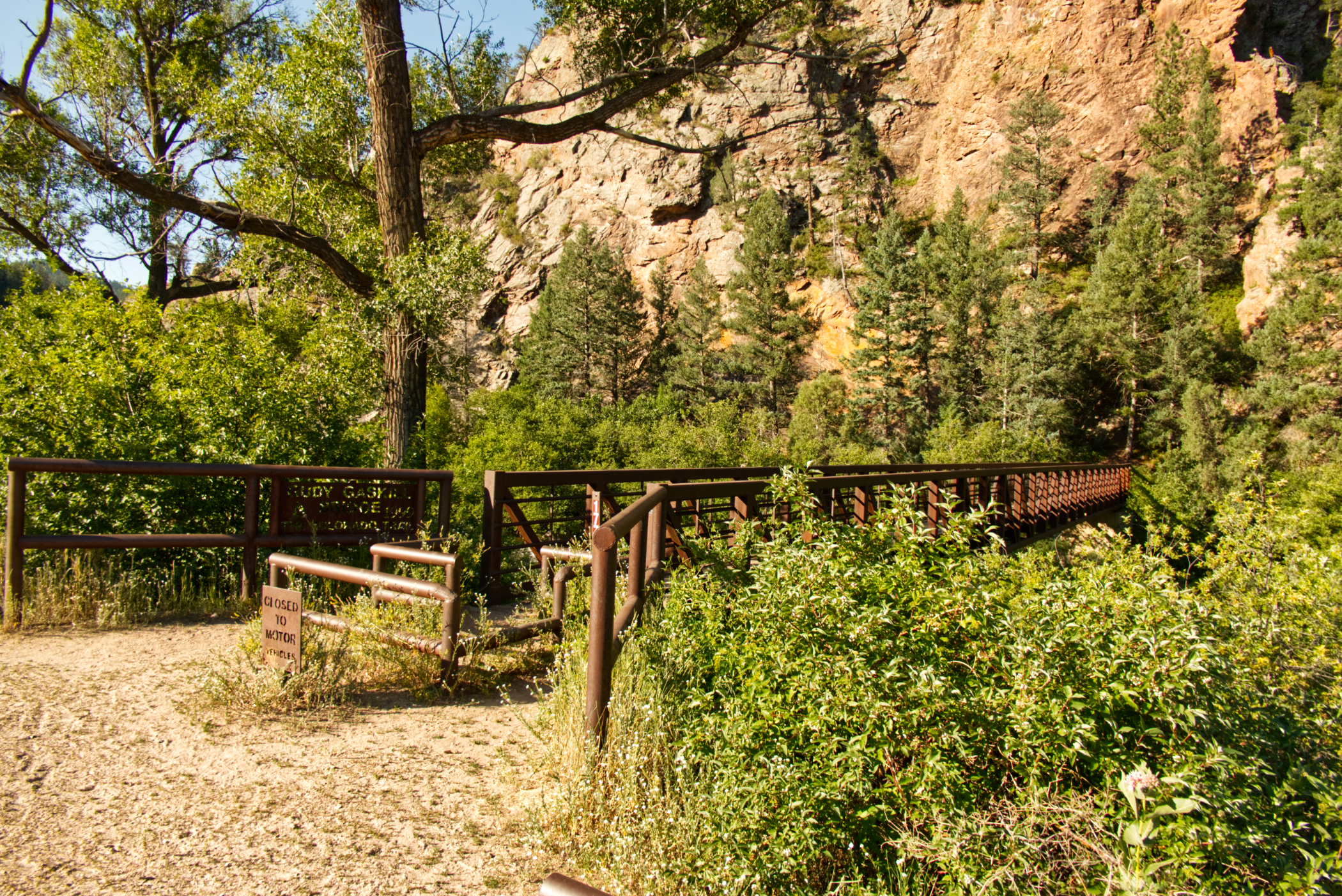
The first steps of the day across Gudy Gaskill bridge
With my little experience so far, I was a tiny bit worried about how I’d handle the heat. But when I finally took off, I was awake, my water bottles were full, and I actually felt ready(ish) for the challenge! Most of the other hikers camping near the river had already set off by then.
Just above South Platte River
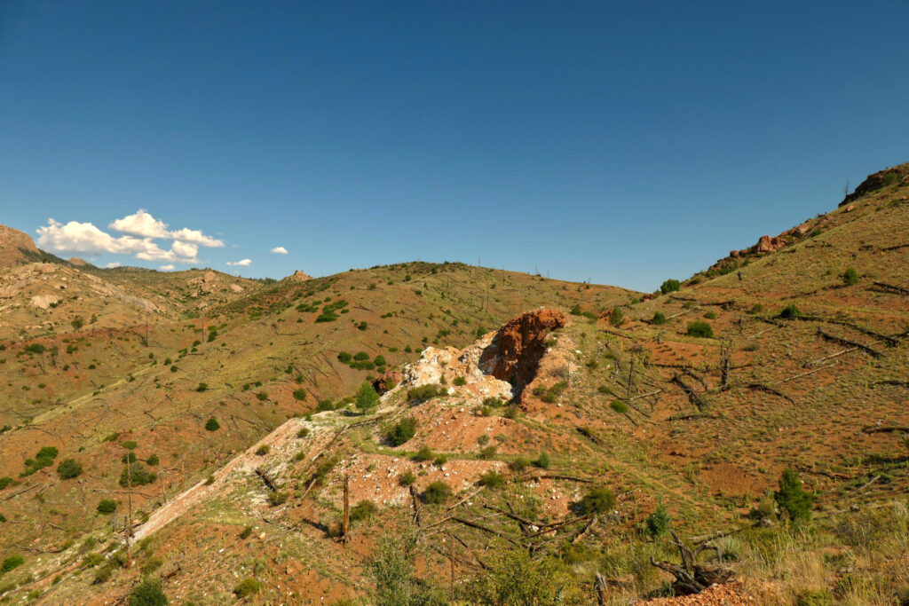
The temperatures were still okay in the beginning. After the first climb, I reached the burn area pretty soon. I visited the outlook near the old quartz mine – a wonderful panorama of the mountains and valleys all around. I was also impressed by the vegetation pushing through the scorched ground and I saw some nice birds.
Hiking through the burn area
When I reached the forest again, it had gotten quite hot. I took my first rest and snack. Getting back into the forest didn’t really help – no wind at all, just that heavy, pressing silence. So yeah, I was soaking wet by now, and the hike became a slow simmering effort.
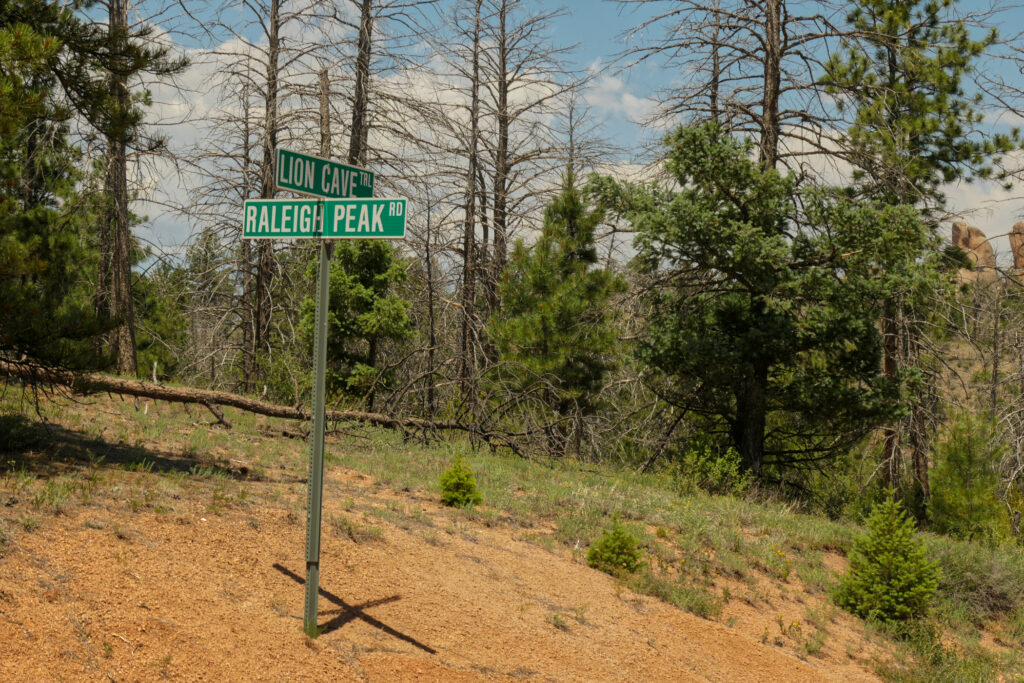
Close to Raleigh Peak Road, I decided to take a break a little after noon. Actually, I stayed for 2½ hours – charging my batteries with the solar panel, drying my t-shirt and hat in the sun. And mostly resting in the shade. That was really helpful. And although it was definitely hot, I didn’t melt entirely – I could handle the temperatures quite well.
Road sign in the middle of nowhere
The only thing was – I also had to drink during my rest. So my water bottles emptied a bit more than I had planned. The good thing: after my rest, the sky got cloudy, and the sun wasn’t that strong anymore when I continued. A small mercy.
Back towards the burn area. And I think that’s Pikes Peak in the distance (?)
Back on the trail, after a short distance, I entered the burn area again. Now with only little ups and downs – quite pleasant. The scenery: Raleigh Peak, granite rocks, dry hillsides. And wait… was that Pikes Peak in the distance? Fantastic.
I really enjoyed this part – although I was soaking wet again right after my break. Since my water was limited, I used my GPS watch to have a sip every 500 meters. Gamifying hydration – worked surprisingly well. My body didn’t feel too bad, but I guess I had to trick myself a little bit here 🙂
Somewhere along this stretch, I lost my National Geographic trail map. It’ll come back to me later – that’s a story for another day!
Finally – water was available at the fire station in the distance…
Getting closer to the fire station with water supply, I met hiker Greg. We walked the last stretch together. When we reached the station, we both took an extra-large, borderline ceremonial sip. Filling up the bottles felt wonderful! Two bike packers – father and son – were there as well. Hope their ride to Durango went smooth!
From there, Greg and I hiked a little further. We crossed Hwy 126 and found a place for the night between some trees, with a nice view toward the mountains.
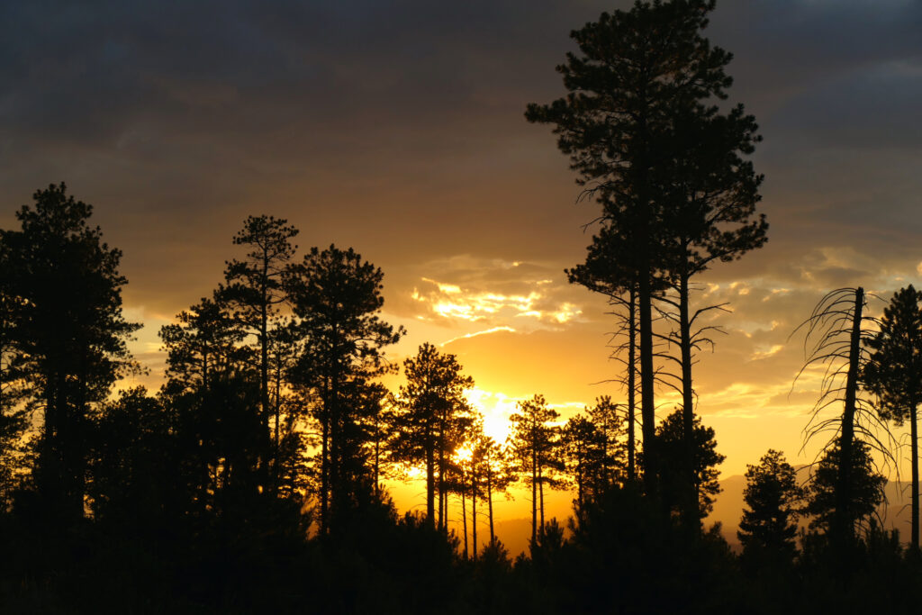
Hummingbirds were flying around, and there was a spectacular sunset.
Sunset near my tent
I was quite proud of how I handled that day – and the heat. So far, things were going really well.
Tips, experiences, lessons learned
Hiking this segment during the week seems smart. The few mountain bikers I saw were super nice and alert. But I imagine it gets a bit more hectic on weekends.
Of course, getting an earlier start would’ve helped. So next time I’ll try to be quicker in the morning 😉 But taking a proper rest around noon in a shady spot – maybe with a bit of a breeze – was a good idea. No need to push through the hottest hours from noon to 3 pm…
And yes: REALLY take enough water. And don’t forget the electrolytes.
Other than that, the hike itself is very pleasant, and the trail is in good shape. Some spots have a lot of gravel going uphill – so careful steps help.
Oh – and don’t put maps or larger items in the pockets of your hiking pants if they’re not really secure. Sitting down on a tree trunk or rock can make them slip out unnoticed. (Yes, I know, beginner stuff – but sometimes the trail has to teach it anyway.)
Distance hiked: 26,8 km/16,7 mi Elevation: 762 m/2500 ft up Highest point: 2291 m/7516 ft (data from my GPS watch, may be different from the official measurements)
So. That was the day when my long planned adventure finally started.
I had arrived in Denver from Germany 10 days earlier. I spent some wonderful time with family, got adjusted to the higher altitude (from just above sea level to the Mile High City), and finished some final hike preparations.
From Wheat Ridge, my sister, nephew, and niece set off with me at 6:45 a.m. toward the starting point at Waterton Canyon. Around 8 a.m., I was ready to go. My dear family walked with me for about a mile, then it was time for them to turn back—and I was on my own.
Disbelief, excitement, hope, joy, and a hint of anxiety were some of the feelings I experienced. How was it possible that after all the mental and physical preparation, gear selection, the flight to Denver, and the goodbyes to friends and family—I was actually here, taking my first steps on this journey of hundreds of miles? Time is a strange thing. But I also felt genuinely proud that I had trusted my vision, intuition, and feelings about this whole project. Well, how would the next days and weeks unfold…?
The first views on the Colorado Trail before entering Waterton Canyon
There was quite a heat wave around Denver at the time, with temperatures above 38 °C (100 °F). Luckily, by starting not too late, there were still some shaded parts along the road through Waterton Canyon. So the first few miles were quite easy. It was Wednesday—some hikers and bikers were around, but it wasn’t too crowded.
South Platte River in Waterton Canyon
The first miles along the South Platte River were quite nice. I could just hike without paying too much attention to the trail or road, so my thoughts and feelings could flow freely, and my body could adjust to the hike.
I met three women who were also planning to hike the CT, but I didn’t see them again later. Another one—Wayne—I met once more near Copper Mountain Resort. I didn’t see any bighorn sheep, although I frequently scanned the hills around me (ending up with a stiff neck after a while…).
This easy stretch ended at Strontia Dam, where a powerful water fountain was on display—then the first serious ascent began. With the higher temperatures, my shirt was soaking wet very soon.
Strontia Dam
At Bear Creek, I took my first longer break—cooled my feet in the water, ate a few wild raspberries, and filled up my bottles. There were lots of peculiar caterpillars there—they turned out to be Douglas-fir tussock moths. Many fell into the creek but managed to rescue themselves a bit downstream by climbing onto another rock. Funny to watch!
The trail somewhere on the way to the high point of the day
Then continuing the ascent on a sometimes rocky trail, I had another short break at Little Bear Creek, which was still running. More uphill, a few hikers and bikers passing, and heat in the woods with several sunny spots—then I reached a great overlook above the South Platte River. My first thought was to set up my tent here, but when I looked northwest and saw big clouds forming, I didn’t want to risk getting caught in a thunderstorm in such an exposed spot.
The ridge above South Platte River close to the end of Segment 1
So I decided to complete Segment 1 and hike back down to the South Platte River. I was pretty tired and hadn’t planned to complete the whole segment, but the descent was easy, with lots of switchbacks—so considering the second (and most likely very hot) day ahead, it was a good decision after all.
I set up my tent a bit above the river and was surprised to see that other hikers had pitched their tents right next to it. I thought this was private land and that camping there should be avoided. Well, I was happy with my spot—slightly separate and by myself, but not completely alone on my first night.
Just above South Platte River
Of course, I didn’t have a routine yet for unpacking or setting up my tent. I couldn’t even find my socks for the night—everything was a bit slow and unorganized—but I was happy that the first day had gone so well and that I had actually finished the whole segment.
Tips, experiences, lessons learned
I think starting at Waterton Canyon in the middle of the week is a great idea. In the canyon, there were several day hikers and bikers, but after Strontia Dam it got pretty quiet. Although I didn’t start very early, the morning hours were pleasant with some shade along the canyon. Starting later in the day would have been much hotter.
I had assumed I could easily refill my water bottles before starting the first ascent near Strontia Dam. However, I couldn’t find any safe access to the river there. So if you want to replenish your water in the canyon, keep an eye out for better access points earlier on.
In general, I didn’t drink enough on this first day. My urethra hurt a bit, and I had some trouble peeing at night (I have some prostate issues, so that’s a personal warning sign when I haven’t drunk enough). I made sure to take better care of that from then on.
With hundreds of photos and a couple of videos that I made during my hike I soon decided to make a video including my own music and share it on YouTube and Bandcamp.
The idea for the video was to capture the pure nature experience and to give time and space for the viewers and listeners to immerse in the beauty of the Colorado Rockies.
Well, the project got a bit out of control… I had to learn Premiere Pro, select and edit my photos with Affinity Photo 2. Also I put together some data for each day of the hike, searched for plant and animal names using iNaturalist, checked places and names of creeks, mountains, passes and more.
Soon after starting I decided not to make one super long video, but instead split it up into seven videos. The title for the whole series is:
Path of solitude
The first video is a dedication to some dear people that were and are important for my hike and the trail in general. The other ones telling a story in six stages, each stage reflecting a certain experience or energy I encountered during my through hike.
Since I am creating music for haikus for some time (joining the Naviar Haiku Music Challenge) I also decided to write a haiku for each stage.
Well, and finally each video should have a soundtrack that I created with my iPad and software tools (Cubase, Native Instruments plugins, Slate + Ash plugins, Arturia Pigments and many more).
So yeah – it took me months to get the first videos ready, and it is still an ongoing process.
Crossing North Fork Chalk Creek starting segment 4 of Collegiate West
Anyway – knowing that the photos, videos of the hike and my final videos are not perfect, I have finally finished the first two videos. I will write a little more about them in a separate post, but here’s the YouTube playlist and the Bandcamp link for the soundtrack.
More videos/tracks will be added when available (by the way – all videos are ready, but soundtracks are still missing for stage 2 – 6. Stage 2 soundtrack is about halfway done…)
Here are some thoughts and experiences about the gear I used on the trail. I won’t add any links, but some brand and item names are mentioned so you can find them if you want.
First some general thoughts – not only about gear, but buying things in general. You may not agree, and that’s absolutely ok for me. But I still want to raise some awareness at this point. These were some rules that I tried to apply when buying gear:
Try and get gear from manufacturers in your region. That may be the US/Canada, or – in my case, Europe.
Try and avoid „made in China“. I have full respect for the people and culture, but I don’t want to support this dictatorship. No country is perfect on earth, but I love the idea of democracy, free speech etc.
Try and avoid Amazon. Check out your local dealers if available, or find smaller web shops. I don’t want to feed ultra billionaires more than necessary. And in most cases we don’t need a piece of gear or anything to be delivered next day.
And yes, I did not always meet my standards or there was no other choice, but to be aware and choose a better option when possible is important to me.
Ok. If you’re still here after my little rant, here we go with my gear.
I had an Exped Thunder 70. The size was perfect (using a bear canister). It was not really lightweight, but also not too heavy. For the lighter rains it kept everything inside dry. For heavy rain I used my poncho which was shaped to also cover the backpack. What I didn’t like was the squeaking sound it made with every step. Some days more, some days less, but I never found out what made the difference…
So for another thru-hike I might go for a lighter backpack, otherwise this was a good choice.
Tent
I had a Hilleberg Enan, a tunnel/double walled tent. Although again not an ultralite piece of gear, that thing rocked. The inner wall was great especially in mosquito areas. It was sturdy and kept me safe and dry during a night of thunderstorm and strong wind/rain on Snow Mesa.
I also got an inexpensive footprint (not from Hilleberg), which protected the floor of the tent from sharp rocks or piece of wood. Probably also helped a bit as a an extra insulation layer.
Near Long Gulch trailhead
Sleeping
I used a down sleeping bag with an additional silk liner. For comfort I had an inflatable pillow with me. Additionally I had a very thin and lightweight mat to place inside of the tent. That was a bit of insulation, and it also helped that my inflatable mattress (by Exped) wouldn’t move too much on the slippery tent floor.
I was happy with these items. Maybe that extra mat would be something to drop for reducing the base pack weight a bit…
Footwear
I walked with Brooks Cascadia 17. Worked very well for me and I would use them again. One thing I don’t know if other shoes are better:
When walking downhill or sidewards when the trail was gravelly I slipped every now and then (didn’t trip thankfully). But I think one would need really sturdy mountain hiking boots to improve that.
There was a short stretch along Cochetopa Creek (a bit before entering the La Garita Wilderness) on a steep slope with very loose rock. The trail was maybe one foot wide, tilted and the poles could hardly be used for that stretch. That was maybe the most uncomfortable part on the trail for me, as I was really hoping and trying my best not to slip and fall down the steep slope.
I had two pairs Darn Tough hiking socks and one pair for the night, also hiking socks of that brand.
Additionally I had a pair of psychedelic Dirty Girl Gaiters. I actually can’t say how much they helped – as I always wore them while hiking. But of course, hiking in style is important as well 😉
Trekking poles
I used Black Diamond poles. I lost the rubber tips after two days – so much for LNT…, sorry ‚bout that.
Would definitely recommend using poles on the Colorado Trail. They give stability on some rocky sections, help you push yourself up on the long climbs, and make the long downhill stretches more knee friendly. One thing is that in the large talus fields they tend to get stuck between the rocks.
Clothing
I used merino underwear (2 shorts, 1 pair of long underwear for the night) and two merino t-shirts. All from Kaipara, a German brand. Worked very well, I would buy/use them again.
I think I would take another t-shirt next time. Two for hiking, one for entering civilization to have something a bit more fresh.
I had an Ortovox mid layer with merino wool, which was absolutely fantastic, and a down puffy jacket for the evenings and mornings.
I had gloves and a hat (from Fjällräven) and hiking pants also from Fjällräven. I was a bit annoyed that this Swedish brand items were produced in China, didn’t check before buying. I had a mosquito net for the hat/head, but never used it…
For rain I had a rain poncho which was big enough to also cover my backpack. It worked very well, but it was an art to put that on. I’m glad that nobody saw me, I think it would have been a nice episode for a thru-hiking comedy…
Also I had rain pants that I never used. So that’s one item I would not take with me next time.
Sunglasses plus case.
Containers
I chose the Bear Vault as my food container. A bit heavy and big in the backpack, but easy to stow away in the evening. Also I heard a story on the trail about a chewed up Ursack. The bear didn’t get the food, but everything inside was messed up, and the hiker had to do an extra resupply trip.
I also had some extra stuff sacks with me, and big sturdy trash bags to definitely keep the important things dry in my backpack.
For my camera and some quick snacks I used a Wandrd fanny bag. It was a great protection for the cam and very useful, but it’s a bit heavy for a thru-hike.
Water
I got myself a Katadyn Befree to filter the water. And an extra 5 l water bag that I could fill with unfiltered water as needed for some dry stretches on the trail. I sometimes washed socks, t-shirt or the underwear in one of the water proof stuff sacks with a bit of soap.
For the supply while hiking I had two simple plastic water bottles from the grocery store with me and two bottle holders connected to the shoulder straps of my backpack. This worked very well for me!
I was very happy with the Katadyn, but it did clog and I used the spare filter (sent to Monarch Pass) after the Cochetopa Hills section with a lot of muddy waters.
Hygiene
I used a regular toothbrush, and tooth tabs from German brand „Terrorists of beauty“, also a piece of soap from them. A small bottle of hand sanitizer and a few alcohol wipes. Dental floss for teeth and also for repairs.
I also took a plastic razor with me. No need to shave each day, but I just didn’t want to grow a messy beard…
For peeing at night I had a plastic bottle with a big opening with me. Worked great, except that one night when I missed the opening half asleep. I leave the rest to your imagination… 😉
Also – although considering myself as a male version of a human being, I used a Kula Cloth during the day. As I need to pee quite often I felt more comfortable using this regularly.
For the poop I used a shovel, but was often not very successful in digging a hole that was deep enough – how do other hikers get through the rocks and roots in the ground? For cleaning I used a little shower called „Happy Po“ available here in Germany (Europe?) which was really great. Would definitely recommend that, no toilet paper needed, and it feels really clean.
First aid
Various kinds of band aids, Ibuprofen and also pain reliever with caffeine, acetaminophen, aspirin (in case of one of my bad headaches). Sewing needle, sun protection. An emergency blanket.
Electronics
My iPhone with a GPS app (Maps 3D) and the Colorado Trail route added from GPX file. I didn’t want to use one of the social hiking apps, keeping the iPhone turned off as much as possible during the hike. I had downloaded some music and brought small headphone to listen to some music in the tent. Actually I only did that for two or three times – my system somehow wanted to be connected to the outdoor sounds (or silence) even in the tent.
Garmin inReach – it was great for my family to see my progress with the regular waypoints that it would send. And of course there is the emergency button, which I thankfully didn’t need to use.
A Suunto GPS watch. I just recently found out that this „Finnish“ company actually has been sold to a Chinese enterprise some years ago. I didn’t pay attention to this before buying 🙁 Although I was and am very happy with the watch itself.
An Anker solar panel (one of the few things I ordered at Amazon).
A Panasonic Lumix DC-TZ202D as a camera plus spare batteries for photos and videos. This worked great, but I really had some problems with focussing with my (sun) glasses. Also there was a correction for videos by default that messed up my panning videos pretty bad.
Note to myself: spend more time with the camera features before going out for a trip!
Cables and adapters. A headlight. An Anker Power Bank (half the capacity/less weight would have been enough since I also had the solar panel with me).
Tools and extras
A tiny Swiss army knife with a pair of scissors. A lighter with some duct tape wrapped around it. A couple of cable ties and some cord.
A Rite in the rain book as diary, and a simple ball pen. A zip lock bag for money, credit card and passport.
Navigation
I mainly used the Colorado Trail Data Book to plan the next two or three days, and also checked often during the day for the next water or the distance to the next place to sleep. That was perfect for most of the time. A few times I checked my GPS app on the iPhone, but most of the time that was turned off.
I had the Colorado Trail maps from National Geographic with me. I didn’t use them during the day, but it was nice to spend some time in the evening checking all the names and topography of the mountains, creeks, passes etc., or get a better feeling of the ups and downs of the next day.
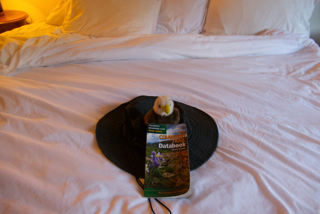
Bird checking the databook and getting me out of bed at the Monarch Mountain Lodge
Bird
I wanted to have one little friend with me, although I planned to stay by myself most of the time. This was „Bird“, a little white eagle that shared the trail with me. That one has been with me for some years, and now it was time for bird to see some of the big world out there 🙂
Looking back to the time on the trail I really must say that the most important things worked out very well, and I’m very thankful for that.
I stayed in good health and had no injuries. There were no dangerous situations with bears, moose, cows, dogs, people etc. All the resupply packages arrived in time, and were in good shape. When hitchhiking I got a ride pretty quickly, and with really nice people.
My gear worked out very well, with a few possible improvements.
People on the trail were super nice, and yes there were some „characters“ on the trail – but that goes for myself as well 😉
I had two trail magic surprises, one near Camp Hale, the other on Lujan Pass. Thank you so much for offering beverages, fruit, sweets and even Pizza. And just being there, knowing how much that can make the day for a thru hiker!
Also on my zero days I had wonderful encounters with people in the hotels, motels, restaurants, shops etc., especially in Twin Lakes, Creede and Silverton.
So when I write about my „ordeals“ most of them are not really too serious – but on these long hours and days out on the trail my mind sometimes got stuck on these things.
Knowing how much of an effort it is to maintain the trail, and with all my full respect for all the trail crews and everyone who is involved:
There were a few sections that were quite challenging to hike. And I don’t mean the long ascents to Hope Pass, the Tenmile Range etc.
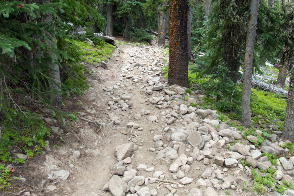
Spoiled from the trails in the European Alps, I really missed having switchbacks in some places. The trail around Holy Cross Wilderness, and the days in the Cochetopa Hills were the worst. Straight up the hill, all in the woods, no „reward“ on top with a nice view. Straight down again. Repeat.
Combine that with a super rocky trail with fist size rocks all over the place. No chance to look left or right, no way to get into a steady hiking pace…
Rocky trail in the Cochetopa Hills
Looking back to these sections I can laugh now, it’s just crazy how the mind wants to change the reality instead of just accepting it and then make the best out of it…
Humidity
When planning the hike I had the idea that in Colorado, and up in the mountains the climate in general would be rather dry with low humidity.
Well, I learned that rinsing my sweaty T-Shirt or socks in the afternoon would repeatedly result in still very damp clothes next morning. Even when there was no rain late afternoon or in the evening things just wouldn’t dry.
Putting up a tent next to a creek also was not the greatest idea (in a place where hikers have camped before me). Not only the outside of the tent was wet, but also the inside from the condensation. Yes I have read about this before my hike – but I guess I had to experience it myself…
So after a couple of days I had my (almost) daily „yard sale“ some time during the day – spreading my tent, the sleeping bag and everything else worth drying in the expanse of the Colorado Rockies…
Mosquitos
Between the Holy Cross Wilderness and Twin Lakes this was pretty bad. Yes I had a repellant with me and that did help a bit, but still these little creatures decided to taste my blood every 30 seconds or so.
While observing the situation I found out that about 2/3 of the mosquitos were on my left arm, only 1/3 on my right. I had the repellant on both arms, so there must have been another reason for this difference. My mind was busy doing calculations and making a scientific research out of this, so that helped to keep my humor alive…
The situation lasted for 2 – 3 days (it was bad in Twin Lakes, but on my zero day there I took a shower, reducing my body odor and mosquito attacks), before and after this section mosquitos were mostly rare.
It was great to have a two layer tent…
Food
That was a somewhat more serious issue. I had decided to go „cold“, so no cooking, just nuts, energy bars, figs, raisins, beef jerky, little salamis etc.
I would do it again without a stove. But I had actually worried too much about resupply and having the „right“ food. Even in the little Jefferson market there would have been enough to resupply. And besides always carrying some extra vitamins and definitely electrolytes I just would go with the available choice. Also except the first few days, temperature for a good supply of chocolate is no problem.
Message to myself for the next thru-hike: Dare more junk food.
Another thing that I didn’t expect was that I just didn’t have a good appetite on the trail. Several people reported of a „hiker hunger“ kicking in after few days, but that was not the case for me. So within the five weeks I lost a good amount of weight, and I think at the end of my hike through the San Juan mountains I was really running out of fuel. I tried my best to eat my dried fruits and nuts, salamis etc. but I am sure it was not enough.
Well, that was definitely a lesson learned for me, to be more conscious about having a good and regular supply of calories.
Another thing: Taste the products before carrying them with you. Of course one never knows for sure how the taste may change during a long hike. But if you know that you hate something, don’t carry it. I say this because I had a good supply of Cliff Bars with me, I had never tried them before. I thought that would be „good calories“, but I hated them so much I really had to swallow them down with lots of water…
Weather
Maybe the most serious of my points here. Although looking back I was quite lucky with the weather, I didn’t expect that it would be so unstable.
I thought there would be afternoon thunderstorms in some places, but found out that rain and thunderstorms can come in at almost any time. One was at 10 pm in the morning. I had two evenings/nights with hours of rain, storm and thunder above treeline (the center of the thunderstorm stayed maybe 2 km away from me luckily). When I kept seeing this towers of dark clouds building up, I just got tense and it really changed my „flow“ of hiking, especially on my last days in the San Juans, around Snow Mesa etc.
In lower altitudes that was not so much of a problem, but around Collegiate West and the San Juan segments, this is something every hiker has to cope with (may vary each year, and within hiking season, of course).
One idea is to make a descent to treeline heights in between, maybe have a late afternoon and a good night „in safety“ before going up again. Just to relax the nervous system for a few hours
In summer 2024 from 10th of July to 10th of August I solo-hiked the Colorado Trail, starting near Denver at Waterton Canyon, finishing at Molas Lake close to Silverton.
This was a truly remarkable adventure, and the culmination of my plans and preparations that started almost two years earlier.
Waterton Canyon
It was some time in 2022 when I first read about the Colorado Trail on some web site I don’t remember. As I have family in the US, and I have travelled the Rocky Mountains (Colorado, Wyoming) quite a bit in my life, I was immediately hooked.
Until then my longest „thru-hike“ was a five day back pack trip through the French Vosges mountains, plus a few three day hikes. However, the idea for a longer hike was already growing in the back of my head – a friend had hiked the Camino del Norte in Spain and had a great time, and I read a wonderful book about the „Shvil Israel“ – the Israel trail.
After first reading about the Colorado Trail it didn’t take long to make the decision to actually do the hike. That was in late summer 2022.
Of course such a project would require some preparation, so I decided to plan for summer 2024. The real preparations started in late 2023 – watching lots of YouTube-Videos about thru-hiking, gear and experiences of other hikers, buying and trying out gear, and putting together everything that had to be organized (flight, supply on the trail etc.). Then early 2024 I started with my training plan – starting to hike three to four times each week for 6 – 10 km with some weight in my backpack. Distance and weight was increased getting closer to summer. Also two three-day hikes with most of my gear (shoes, backpack, water filter etc.) somewhere in the German woods.
Some of the gear – such as the Bear Container – was not available here, so my family in the US ordered it.
Then on the 10th of July the fun started in Waterton Canyon, around 8 am in the morning. I was overwhelmed by my feelings to actually be on the way now.
Over the next 36 days I had one of the greatest and most demanding experiences in my life so far. I got lots of support from my family, met great people, and was just deeply touched by the nature and the scenery I experienced.
From my photos and videos I created (and at the time of writing I’m still creating) seven videos that can be watched on YouTube.
I will post more about my hike and the videos. Stay tuned…