Schlagwort: 2024

  • Colorado Trail 2024 – Day 4 – Border of Lost Creek Wilderness to Long Gulch 

    Colorado Trail 2024 – Day 4 – Border of Lost Creek Wilderness to Long Gulch 

    Colorado Trail 2024 – Path of Solitude – Day 4
    Border of Lost Creek Wilderness to Long Gulch

    Distance hiked: 25,1 km/15,6 mi
    Elevation gain: 785 m/2575 ft
    Highest point: 3331 m/10928 ft
    (data from my GPS watch, may be different from the official measurements) 

    Disclaimer: 
    Human written post with some minor AI improvements (to improve non-native speaker flaws). Photos edited in Affinity Photo 2 

    Today, there was a subtle but noticeable shift – both in the landscape around me and in how I experienced it. This had a lot to do with the gain in altitude, now reaching well above 3,000 m / 10,000 ft. That’s more than 1,500 m / 5,000 ft higher than the starting point in Waterton Canyon.

    My alarm woke me at 5:45 am, but I decided to stay a little longer in my sleeping bag. Eventually, that meant I didn’t hit the trail until 8:20 am. Still, I had a peaceful night and felt well-rested.

    A beautiful spot for my tent next to the Lost Creek Wilderness Area

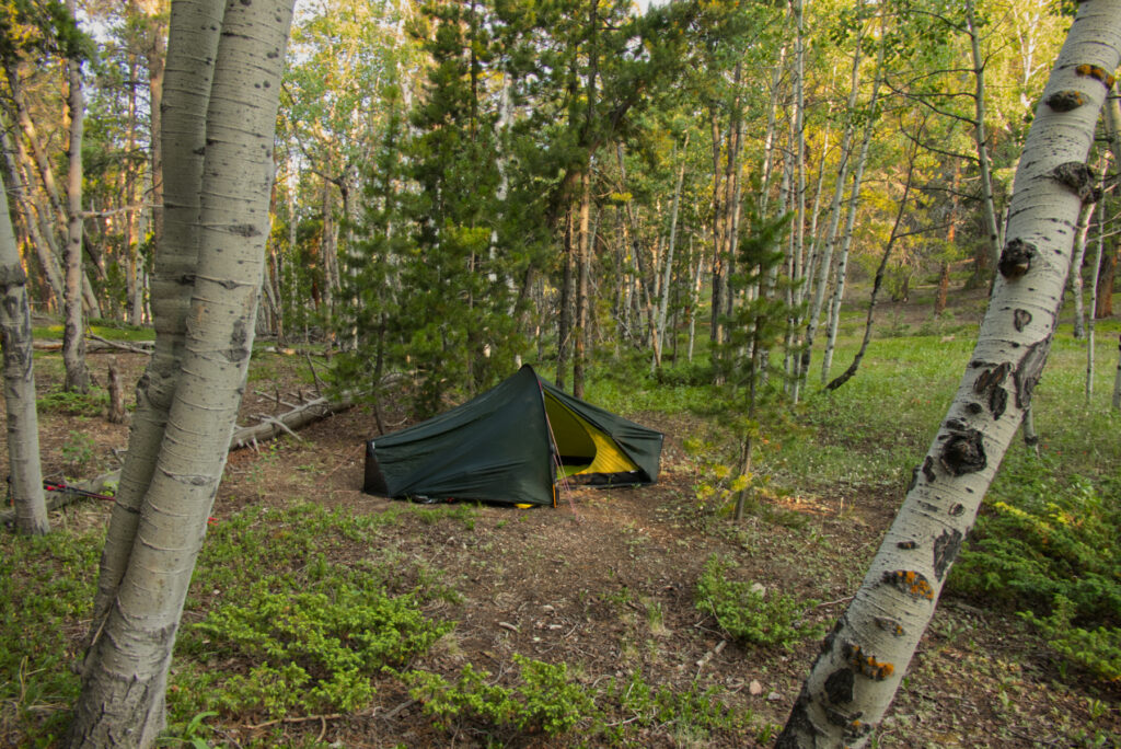
    It was different, waking up completely alone in this beautiful forest clearing. I think it was the first time I truly felt that quiet sense of freedom: choosing my path, setting my pace, planning the day on my own terms. No human interaction, no distractions. Just me.

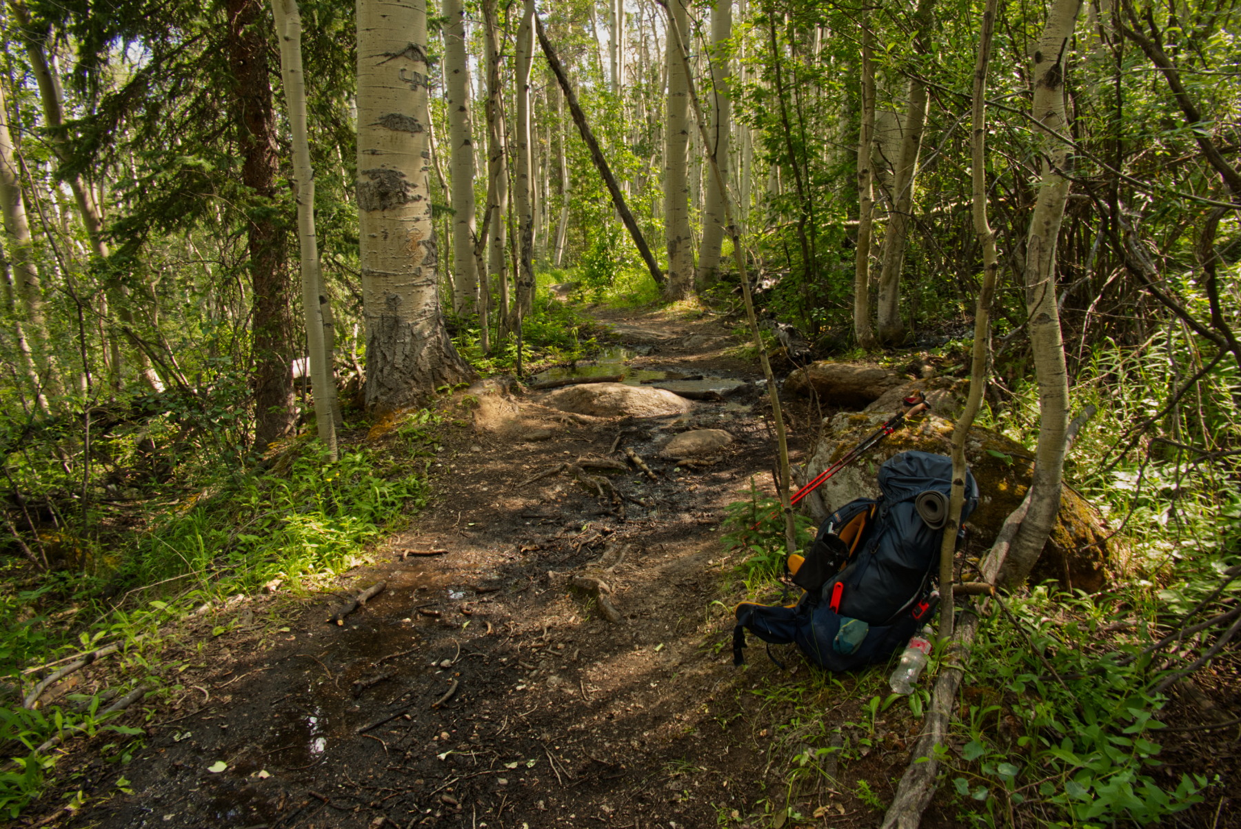
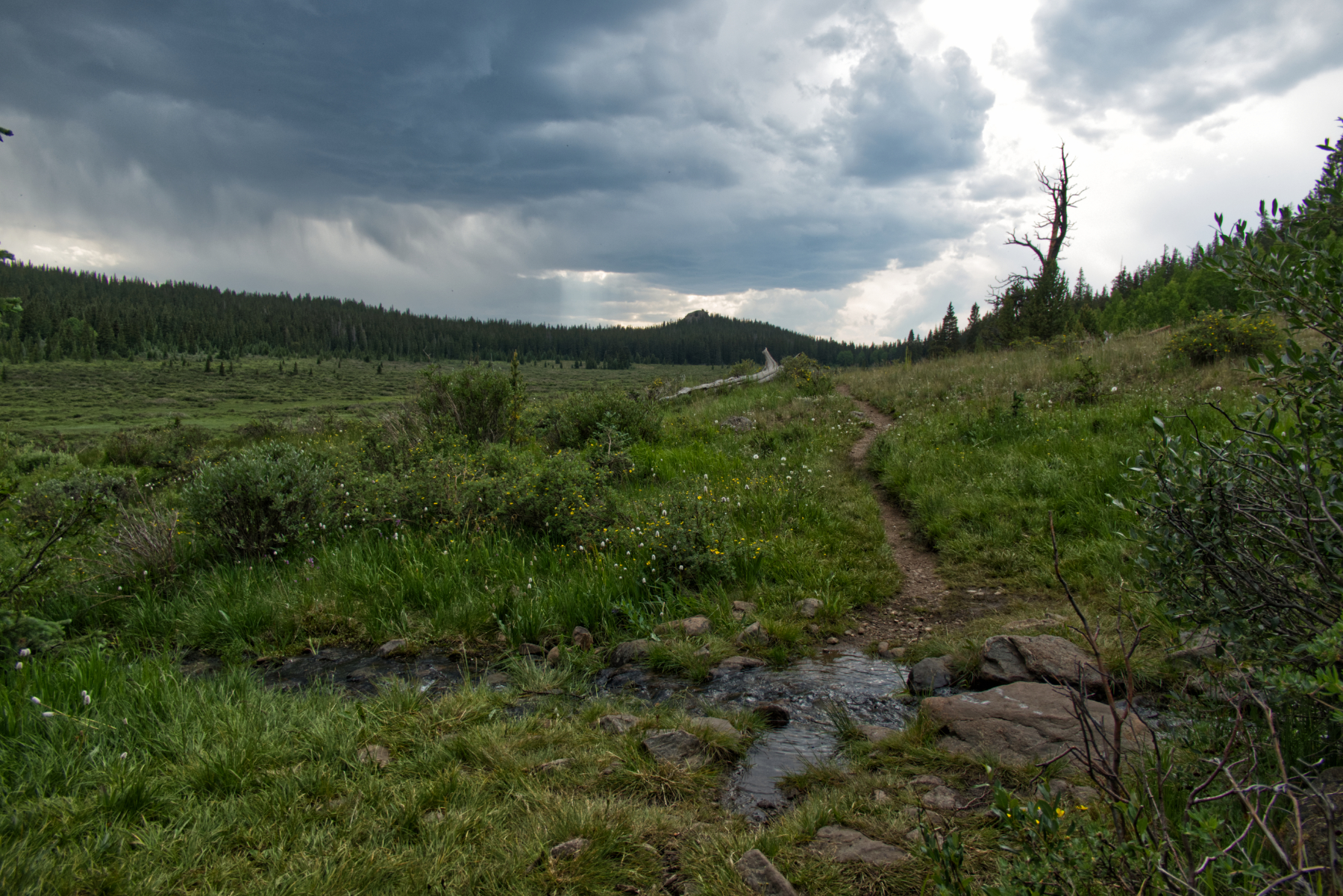
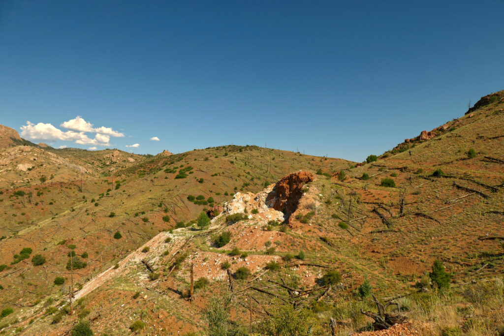
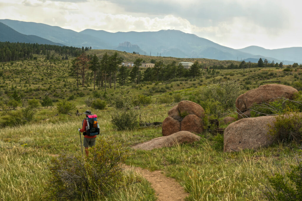
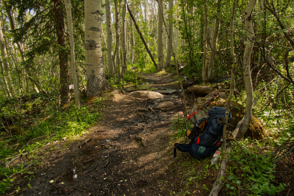
    Not long after setting off, I entered the Lost Creek Wilderness. The trail was sometimes steep and rocky, then eased into lovely aspen groves with little creeks and lots of wildflowers, following an old logging road. After a few miles, the path left the road and turned into a proper leg burner – steep, rooty, rocky. I was huffing and puffing, but eventually reached the first high point of the day.

    A nice place to get some fresh water

    Around there, a small creek invited me to filter some fresh water. A few other hikers showed up, and we shared a short, friendly exchange. And remember how I wrote on Day 2 that I had lost my National Geographic map? Well – one of the guys came over and asked if someone had dropped a map in the burn area… Yep. That was mine. That’s the hiker community for you – helpful, observant, kind.

    That was just one of many little trail moments that make this journey so special. So thanks again, my friend. I’m sorry I didn’t ask your name. We only saw each other once more in Twin Lakes. I hope the trail – and everything beyond – treated you well.

    And yes, I still preferred to hike and camp alone for the most part. But it was nice to feel part of this bigger hiking community, where everyone hikes their own hike, at their own pace, with mutual respect along the way.

    Later, going downhill for a bit, the first thunderstorm of my hike rolled in. I felt safe in the woods, and after less than half an hour, the rain and thunder had moved on.

    Entering the Long Gulch after descending through the forest

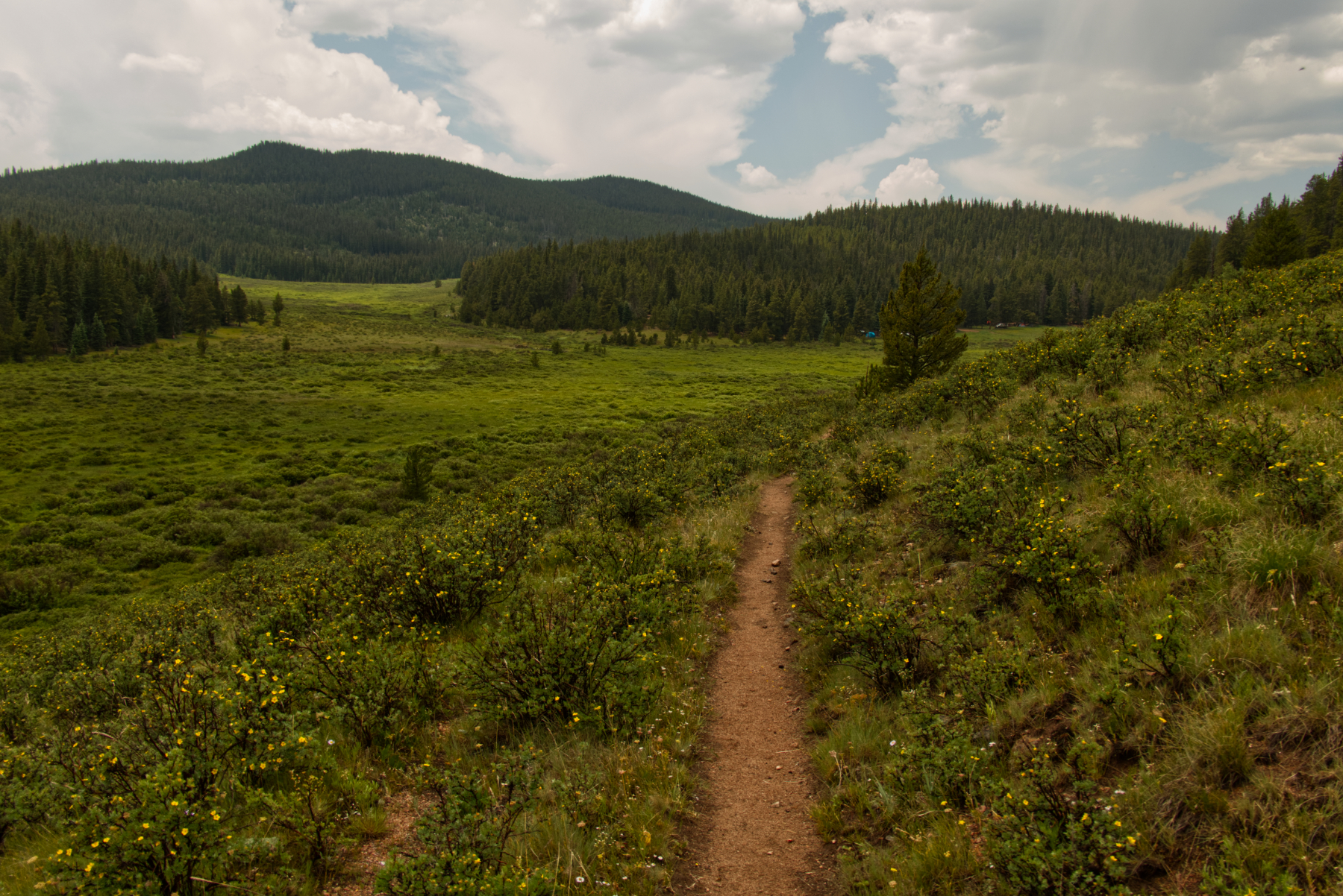
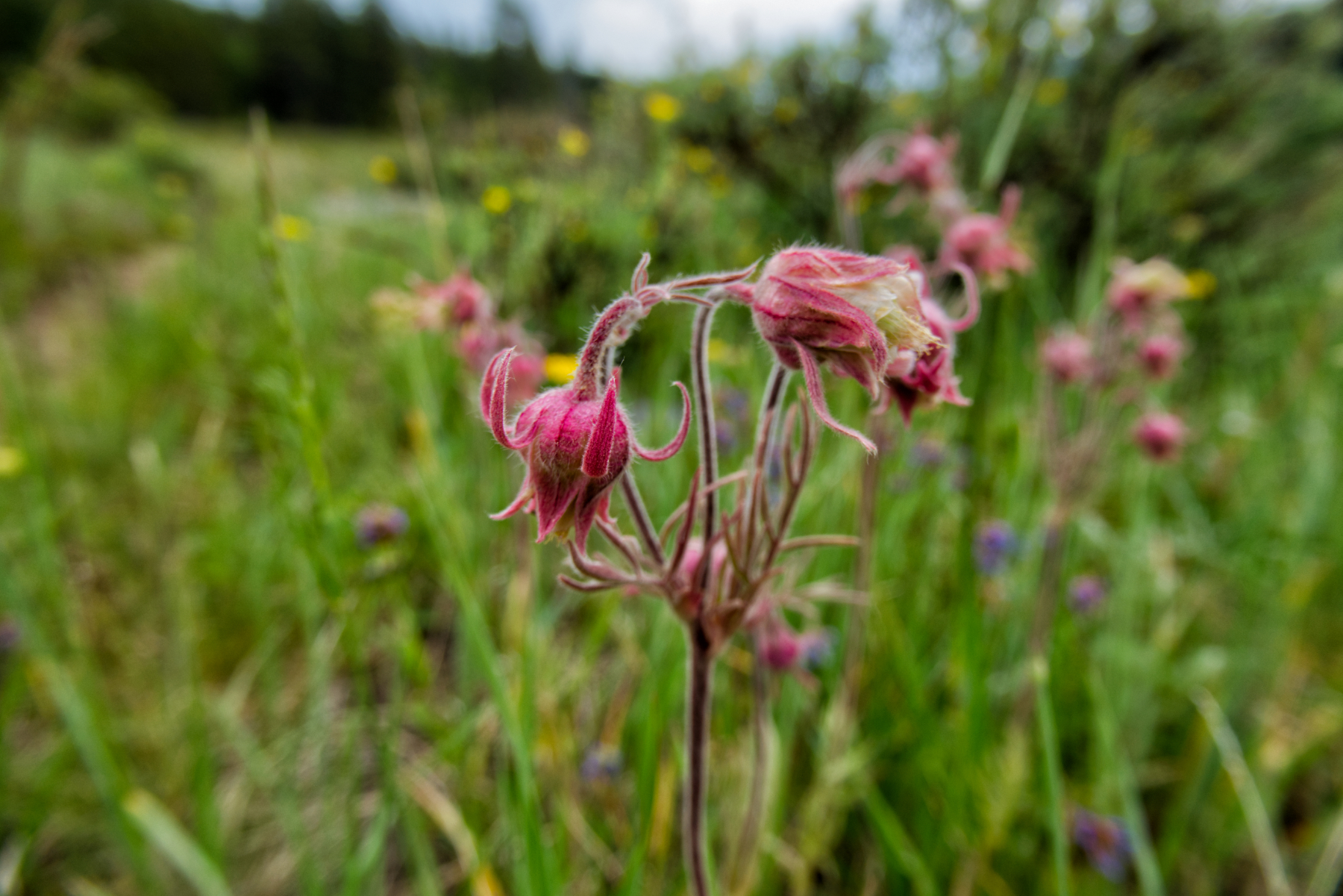
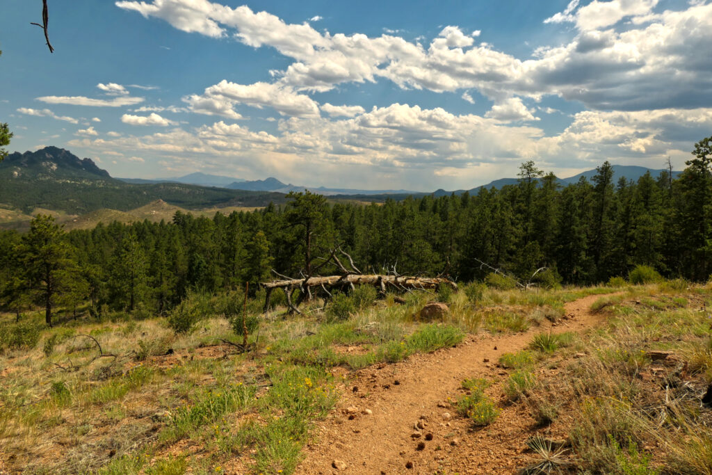
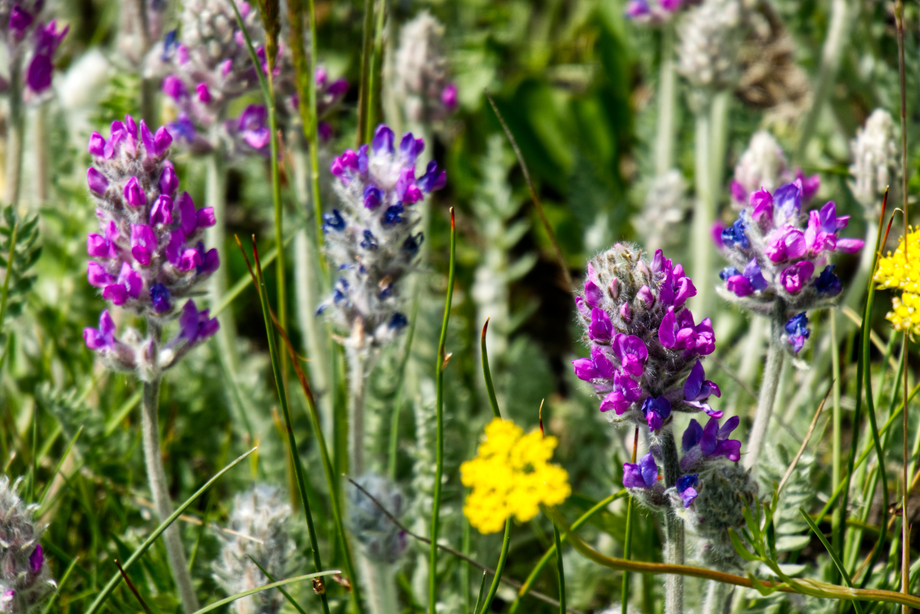
    Then came a stunning stretch, following the North Fork of Lost Creek, also known as Long Gulch. What a place. A gentle, steady ascent. Around every creek, an explosion of wildflowers. Blue skies, white clouds straight out of a postcard. For seven miles, it felt like walking through a painting. And yes, I was sweating again – but the heat had lost its sting compared to earlier days. I paused under a pine tree, aired out my feet, recharged my gear with the solar panel. This part of the trail felt extra good.

    Near the upper end (or beginning?) of Long Gulch

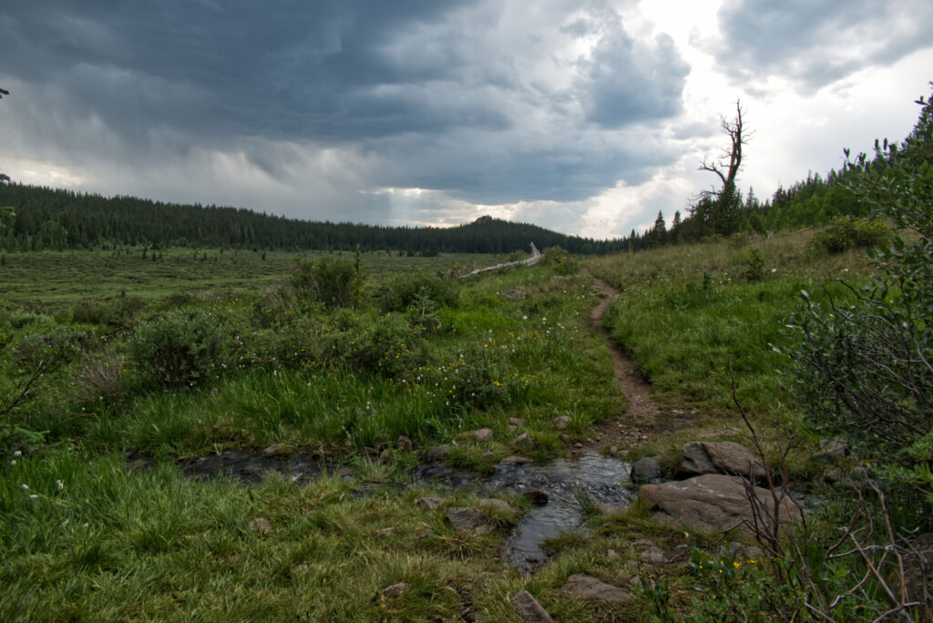
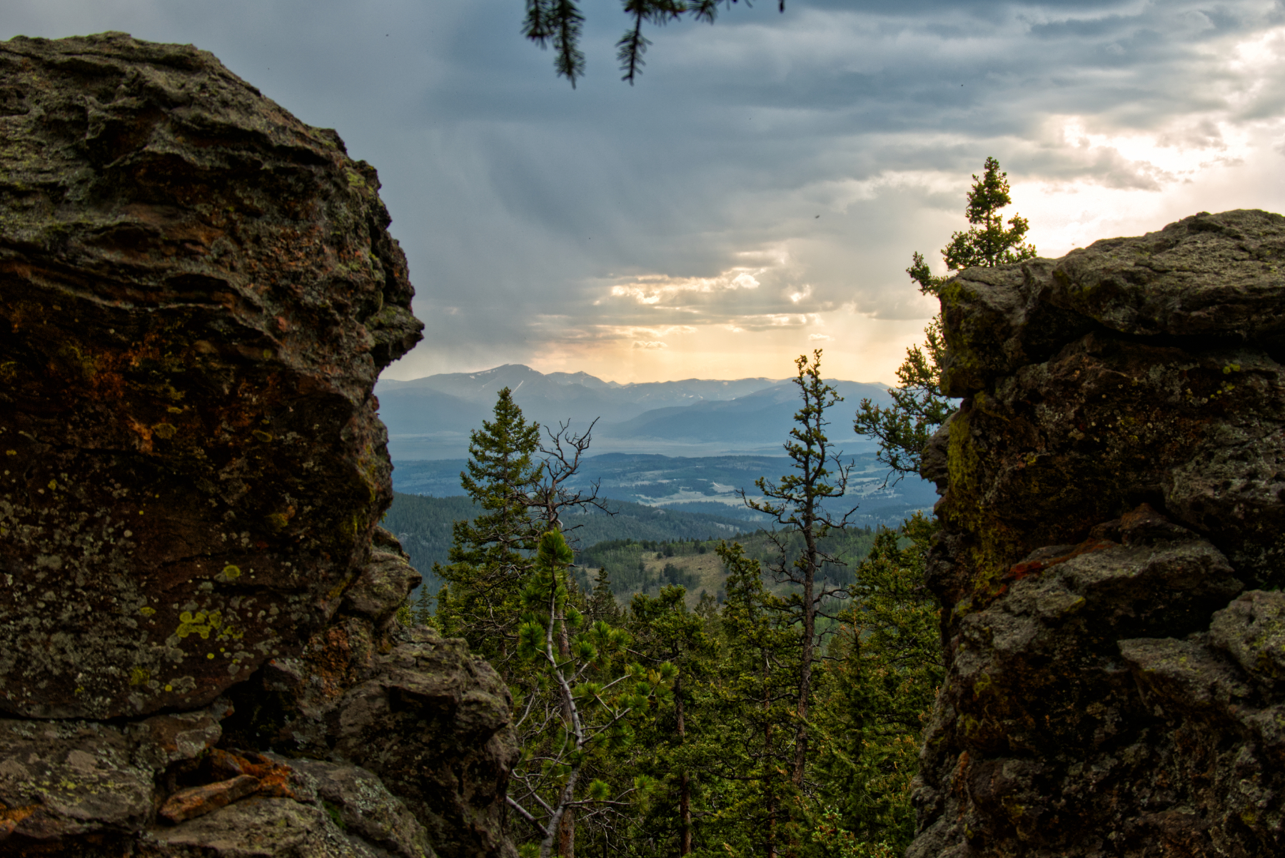
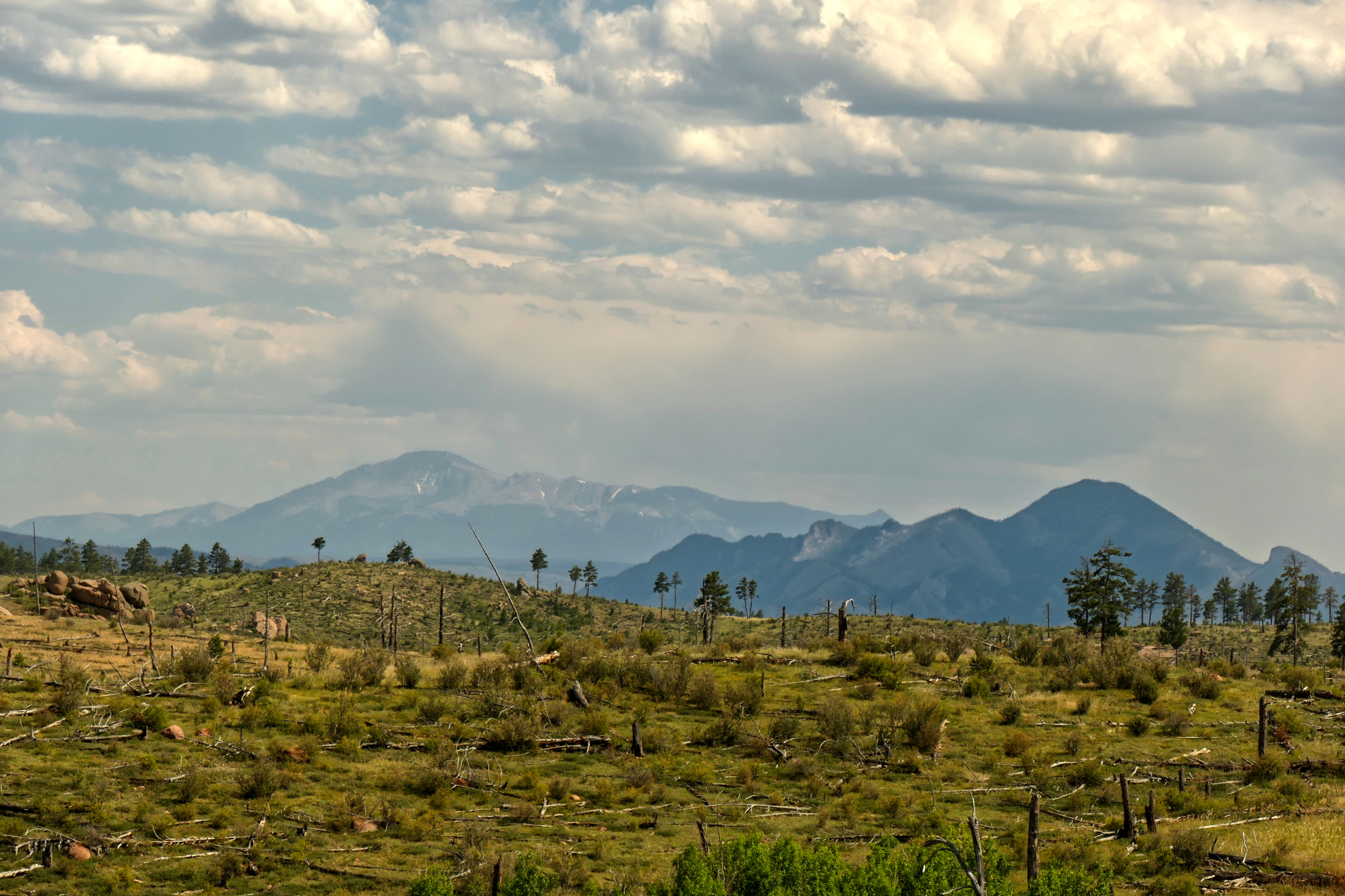
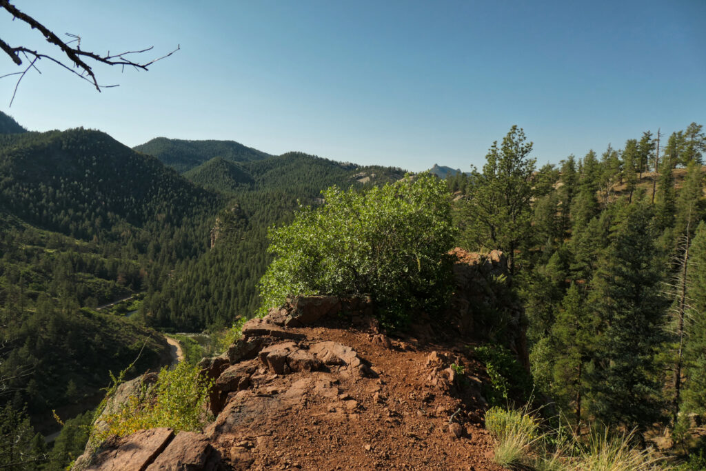
    Eventually, the gulch ended and I re-entered the forest. There were some perfect tent spots, and I met two friendly guys who had already set up camp. But I still felt strong, so I kept going – descending quite a bit until I reached the creek above Long Gulch Trailhead. The skies were already turning gloomy again. A short but spectacular view opened between some rocks – mountain ranges in the distance, a glimpse into the next days of my hike!

    A view of mountain ranges across South Park

    When I arrived, I was a bit shocked – there were about a dozen tents already scattered around. One small spot was still free, but one of the hikers told me there was another site just across the creek.

    I crossed over and found the perfect place for the night. Alone again, just how I needed it to be. I noticed that the bark of some aspen trees had been rubbed off. My first thought (naturally) was: bears. Claws. Yikes. But I later learned these are likely marks from elk or moose scratching their antlers.

    I decided not to overthink it. I stashed my bear canister far from the tent, had a peaceful evening listening to light rain, wrote a bit, and fell asleep deeply.

    Tips, experiences, lessons learned

    One thing I never quite nailed on this hike: water management. I always wanted to be safe and carry enough. But on a segment like today, with plenty of water sources, I probably hauled an extra 1–2 lbs of unneeded weight. It’s not easy to find the perfect balance, but next time, I might trust the map (and my instincts) a bit more.

    Another little lesson: In Long Gulch, there were some mosquitoes. Not terrible – just mildly annoying when taking breaks. While resting under a large pine tree, I noticed that the mosquitos mostly stayed away from the ground covered in pine needles. So at least in this area, pine shade = nap zone. Good to know.

    Slide show

  • Colorado Trail 2024 –  Day 2 – South Platte River Trailhead to Little Scraggy Trailhead

    Colorado Trail 2024 – Day 2 – South Platte River Trailhead to Little Scraggy Trailhead

    Colorado Trail 2024 – Path of Solitude – Day 2
    South Platte River Trailhead to Little Scraggy Trailhead

    Distance hiked: 19,2 km/11,9 mi
    Elevation: 749 m/2457 ft
    Highest point: 2382 m/7815 ft
    (data from my GPS watch, may be different from the official measurements)

    Wow, the first day was over. I was still alive – and just a little creaky after a somewhat restless night. I got up at six in the morning to clear skies and soft light. Putting together my things took longer than planned, so I was finally ready to start hiking at eight. In between, I saw a female mule deer quietly stepping through the brush, pretty close to my tent – a gentle and unexpected morning greeting.

    This segment was mentioned in the CT guidebook as a super hot hike – passing through a burn area from the Buffalo Creek fire in 1996. So: no water, little shade for the next 16 km/10 miles. And we had a heatwave around Denver these days… Great combo, right?

    The first steps of the day across Gudy Gaskill bridge

    With my little experience so far, I was a tiny bit worried about how I’d handle the heat. But when I finally took off, I was awake, my water bottles were full, and I actually felt ready(ish) for the challenge! Most of the other hikers camping near the river had already set off by then.

    Just above South Platte River

    The temperatures were still okay in the beginning. After the first climb, I reached the burn area pretty soon. I visited the outlook near the old quartz mine – a wonderful panorama of the mountains and valleys all around. I was also impressed by the vegetation pushing through the scorched ground and I saw some nice birds.

    Hiking through the burn area

    When I reached the forest again, it had gotten quite hot. I took my first rest and snack. Getting back into the forest didn’t really help – no wind at all, just that heavy, pressing silence. So yeah, I was soaking wet by now, and the hike became a slow simmering effort.

    Close to Raleigh Peak Road, I decided to take a break a little after noon. Actually, I stayed for 2½ hours – charging my batteries with the solar panel, drying my t-shirt and hat in the sun. And mostly resting in the shade. That was really helpful. And although it was definitely hot, I didn’t melt entirely – I could handle the temperatures quite well.

    Road sign in the middle of nowhere

    The only thing was – I also had to drink during my rest. So my water bottles emptied a bit more than I had planned. The good thing: after my rest, the sky got cloudy, and the sun wasn’t that strong anymore when I continued. A small mercy.

    Back towards the burn area. And I think that’s Pikes Peak in the distance (?)

    Back on the trail, after a short distance, I entered the burn area again. Now with only little ups and downs – quite pleasant. The scenery: Raleigh Peak, granite rocks, dry hillsides. And wait… was that Pikes Peak in the distance? Fantastic.

    I really enjoyed this part – although I was soaking wet again right after my break. Since my water was limited, I used my GPS watch to have a sip every 500 meters. Gamifying hydration – worked surprisingly well. My body didn’t feel too bad, but I guess I had to trick myself a little bit here 🙂

    Somewhere along this stretch, I lost my National Geographic trail map. It’ll come back to me later – that’s a story for another day!

    Finally – water was available at the fire station in the distance…

    Getting closer to the fire station with water supply, I met hiker Greg. We walked the last stretch together. When we reached the station, we both took an extra-large, borderline ceremonial sip. Filling up the bottles felt wonderful! Two bike packers – father and son – were there as well. Hope their ride to Durango went smooth!

    From there, Greg and I hiked a little further. We crossed Hwy 126 and found a place for the night between some trees, with a nice view toward the mountains.

    Hummingbirds were flying around, and there was a spectacular sunset.

    Sunset near my tent

    I was quite proud of how I handled that day – and the heat. So far, things were going really well.


    Tips, experiences, lessons learned

    Hiking this segment during the week seems smart. The few mountain bikers I saw were super nice and alert. But I imagine it gets a bit more hectic on weekends.

    Of course, getting an earlier start would’ve helped. So next time I’ll try to be quicker in the morning 😉 But taking a proper rest around noon in a shady spot – maybe with a bit of a breeze – was a good idea. No need to push through the hottest hours from noon to 3 pm…

    And yes: REALLY take enough water. And don’t forget the electrolytes.

    Other than that, the hike itself is very pleasant, and the trail is in good shape. Some spots have a lot of gravel going uphill – so careful steps help.

    Oh – and don’t put maps or larger items in the pockets of your hiking pants if they’re not really secure. Sitting down on a tree trunk or rock can make them slip out unnoticed. (Yes, I know, beginner stuff – but sometimes the trail has to teach it anyway.)

    Slide show

  • Colorado Trail 2024 – Path of solitude – Day 1 – Waterton Canyon to South Platte River trailhead

    Colorado Trail 2024 – Path of solitude – Day 1 – Waterton Canyon to South Platte River trailhead

    10.07.2024


    Distance hiked: 26,8 km/16,7 mi
    Elevation: 762 m/2500 ft up
    Highest point: 2291 m/7516 ft
    (data from my GPS watch, may be different from the official measurements)


    So. That was the day when my long planned adventure finally started.

    I had arrived in Denver from Germany 10 days earlier. I spent some wonderful time with family, got adjusted to the higher altitude (from just above sea level to the Mile High City), and finished some final hike preparations.

    From Wheat Ridge, my sister, nephew, and niece set off with me at 6:45 a.m. toward the starting point at Waterton Canyon. Around 8 a.m., I was ready to go. My dear family walked with me for about a mile, then it was time for them to turn back—and I was on my own.

    Disbelief, excitement, hope, joy, and a hint of anxiety were some of the feelings I experienced. How was it possible that after all the mental and physical preparation, gear selection, the flight to Denver, and the goodbyes to friends and family—I was actually here, taking my first steps on this journey of hundreds of miles? Time is a strange thing. But I also felt genuinely proud that I had trusted my vision, intuition, and feelings about this whole project. Well, how would the next days and weeks unfold…?

    The first views on the Colorado Trail before entering Waterton Canyon

    There was quite a heat wave around Denver at the time, with temperatures above 38 °C (100 °F). Luckily, by starting not too late, there were still some shaded parts along the road through Waterton Canyon. So the first few miles were quite easy. It was Wednesday—some hikers and bikers were around, but it wasn’t too crowded.

    South Platte River in Waterton Canyon

    The first miles along the South Platte River were quite nice. I could just hike without paying too much attention to the trail or road, so my thoughts and feelings could flow freely, and my body could adjust to the hike.

    I met three women who were also planning to hike the CT, but I didn’t see them again later. Another one—Wayne—I met once more near Copper Mountain Resort. I didn’t see any bighorn sheep, although I frequently scanned the hills around me (ending up with a stiff neck after a while…).

    This easy stretch ended at Strontia Dam, where a powerful water fountain was on display—then the first serious ascent began. With the higher temperatures, my shirt was soaking wet very soon.

    Strontia Dam

    At Bear Creek, I took my first longer break—cooled my feet in the water, ate a few wild raspberries, and filled up my bottles. There were lots of peculiar caterpillars there—they turned out to be Douglas-fir tussock moths. Many fell into the creek but managed to rescue themselves a bit downstream by climbing onto another rock. Funny to watch!

    The trail somewhere on the way to the high point of the day

    Then continuing the ascent on a sometimes rocky trail, I had another short break at Little Bear Creek, which was still running. More uphill, a few hikers and bikers passing, and heat in the woods with several sunny spots—then I reached a great overlook above the South Platte River. My first thought was to set up my tent here, but when I looked northwest and saw big clouds forming, I didn’t want to risk getting caught in a thunderstorm in such an exposed spot.

    The ridge above South Platte River close to the end of Segment 1

    So I decided to complete Segment 1 and hike back down to the South Platte River. I was pretty tired and hadn’t planned to complete the whole segment, but the descent was easy, with lots of switchbacks—so considering the second (and most likely very hot) day ahead, it was a good decision after all.

    I set up my tent a bit above the river and was surprised to see that other hikers had pitched their tents right next to it. I thought this was private land and that camping there should be avoided. Well, I was happy with my spot—slightly separate and by myself, but not completely alone on my first night.

    Just above South Platte River

    Of course, I didn’t have a routine yet for unpacking or setting up my tent. I couldn’t even find my socks for the night—everything was a bit slow and unorganized—but I was happy that the first day had gone so well and that I had actually finished the whole segment.

    Tips, experiences, lessons learned

    I think starting at Waterton Canyon in the middle of the week is a great idea. In the canyon, there were several day hikers and bikers, but after Strontia Dam it got pretty quiet. Although I didn’t start very early, the morning hours were pleasant with some shade along the canyon. Starting later in the day would have been much hotter.

    I had assumed I could easily refill my water bottles before starting the first ascent near Strontia Dam. However, I couldn’t find any safe access to the river there. So if you want to replenish your water in the canyon, keep an eye out for better access points earlier on.

    In general, I didn’t drink enough on this first day. My urethra hurt a bit, and I had some trouble peeing at night (I have some prostate issues, so that’s a personal warning sign when I haven’t drunk enough). I made sure to take better care of that from then on.

    Slide show